
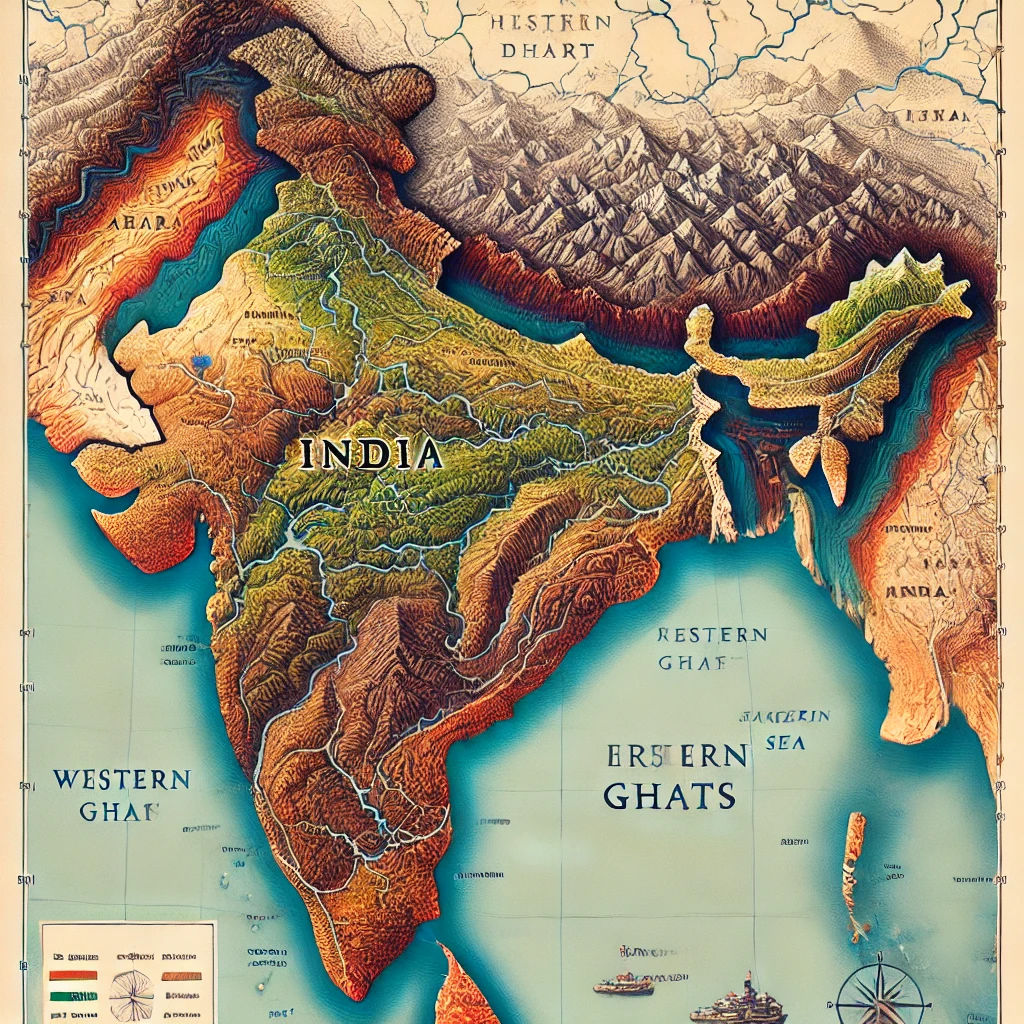
Geographical Area of India
When we look at the map of India, we see not just lines and colors, but a land full of diversity. From snowy mountains to hot deserts, from fertile river plains to deep seas, the geographical area of India has shaped its people, culture, and economy in countless ways. In this article, I am sharing these physical regions as I have understood and experienced them, so that you can see how each part of India contributes to the country as a whole.
If you also want to explore how this geography shapes India’s role in the world, you can read my detailed article on the geographical importance of India.
Introduction to the Geographical Area of India
The geographical area of India is full of diversity. Its expanse is vast and comprises a wide range of geographical features. Broadly, the physical regions of India can be divided into the following parts:
- Hilly region (Himalayan region)
- Gangetic–Brahmaputra plains
- Desert region (Thar Desert)
- Deccan Plateau
- Western and Eastern Ghats
- Coastal areas
- Andaman and Nicobar and Lakshadweep Islands
Major Physical Regions of India
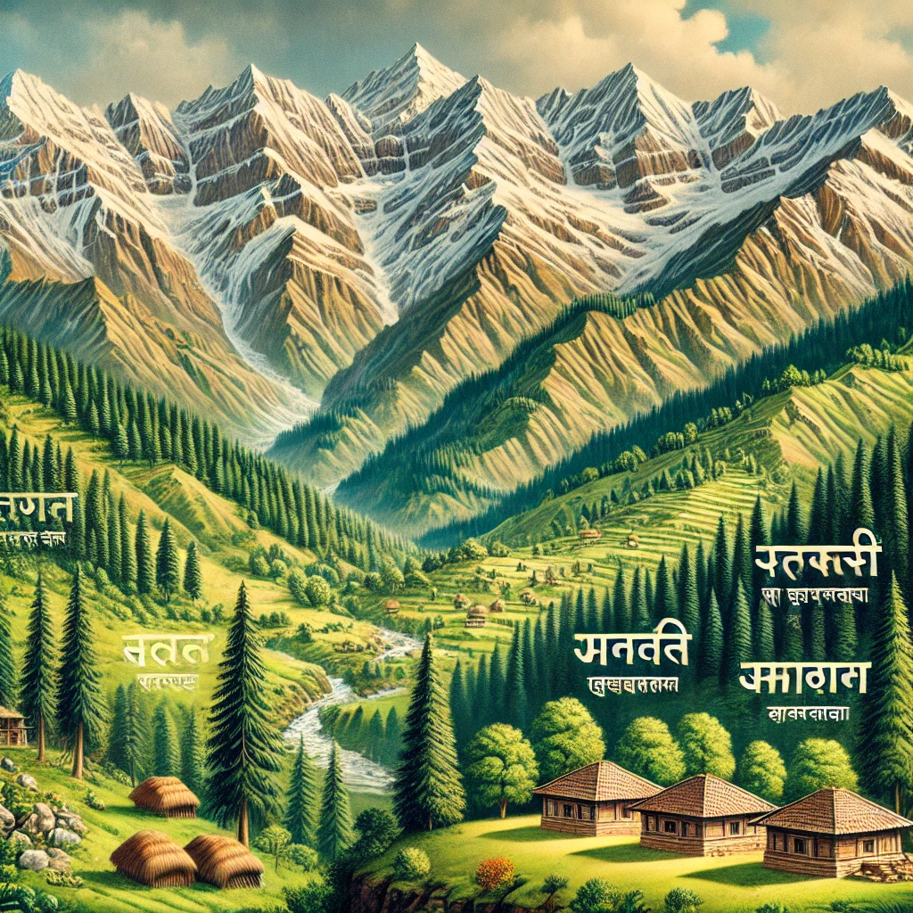
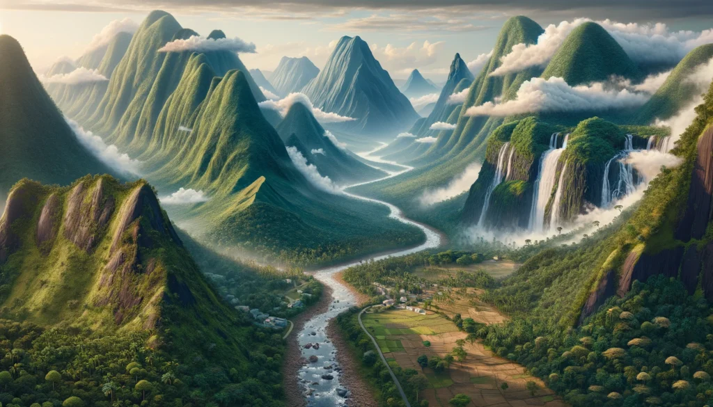
1. Hilly Region (Himalayan Region)
Location
The Himalayan region is located in the north of India. It is the highest mountain region in the world.
Characteristics
- The Himalayan mountain range separates India from China and Central Asia.
- It has three major parts:
- Great Himalayas: The highest range, where there are peaks like Mount Everest and Kanchenjunga.
- Middle Himalayas: This region includes famous hill stations and tourist places like Mussoorie, Shimla, and Nainital.
- Shivalik Mountain Range: The outermost part, which is of relatively low height compared to the other ranges.
Importance
The Himalayan region is significant for India’s climate, vegetation, and water sources. It acts as a natural barrier, protects the country from cold winds, and is the source of many major rivers.
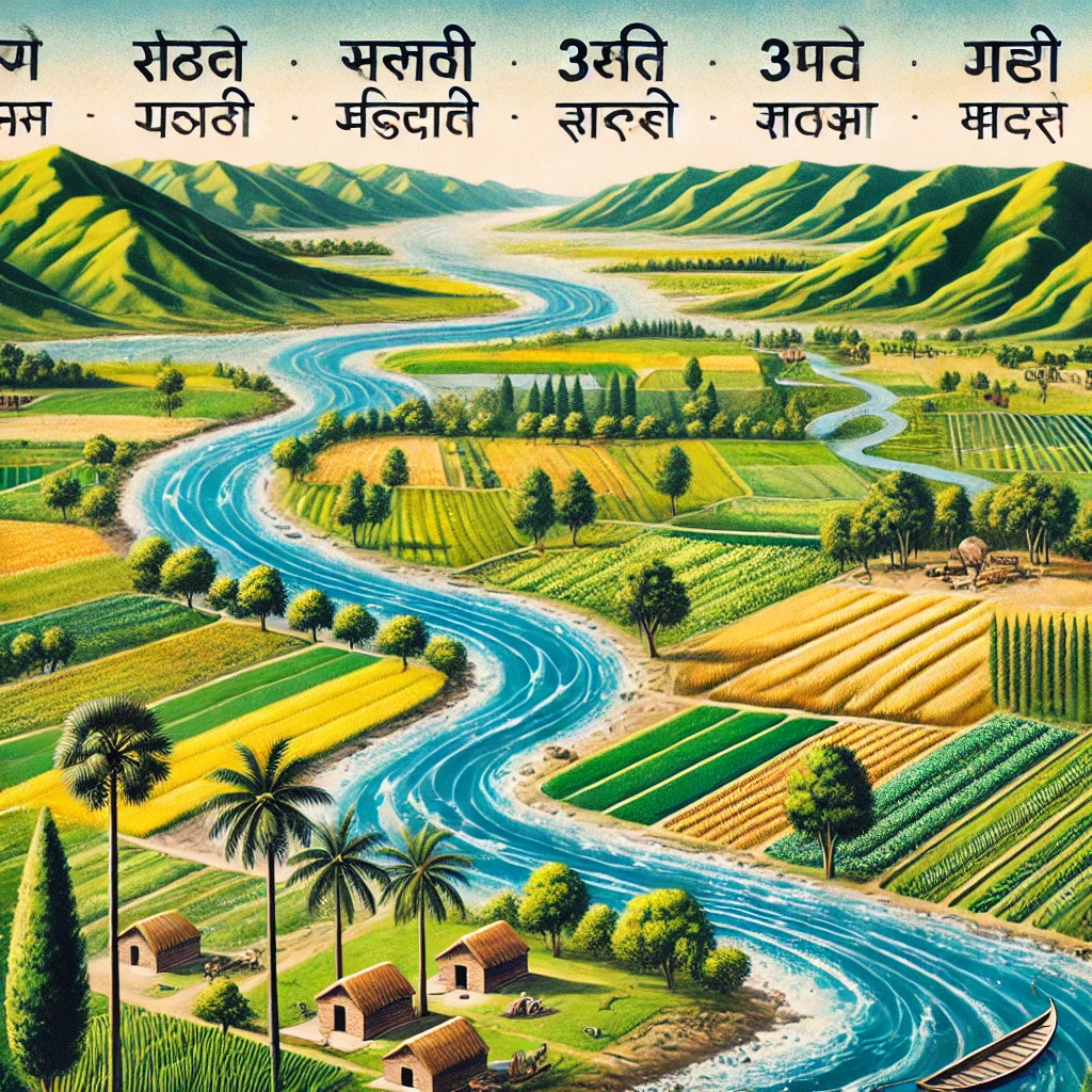
2. Gangetic–Brahmaputra Plains
Location
These plains are spread across the northern and eastern parts of India.
Characteristics
- The rivers Ganga, Brahmaputra, and Yamuna flow through this region.
- This plain is very fertile and is often called the “granary of India”.
- The Ganges delta, called the Sunderbans, is a major centre of biodiversity.
Importance
This region is extremely important for agriculture, dense human settlements, and water resources. A large part of India’s population depends on these plains for food and livelihood.
3. Desert Region (Thar Desert)
Location
The desert region is mainly located in Rajasthan and its surrounding areas.
Characteristics
- The area is dry with very little rainfall and sparse vegetation.
- It is famous for sand dunes and a generally dry climate.
Importance
The Thar Desert is famous for camel rides, traditional culture, and unique desert tourism. It also has strategic importance and a growing potential for solar energy.
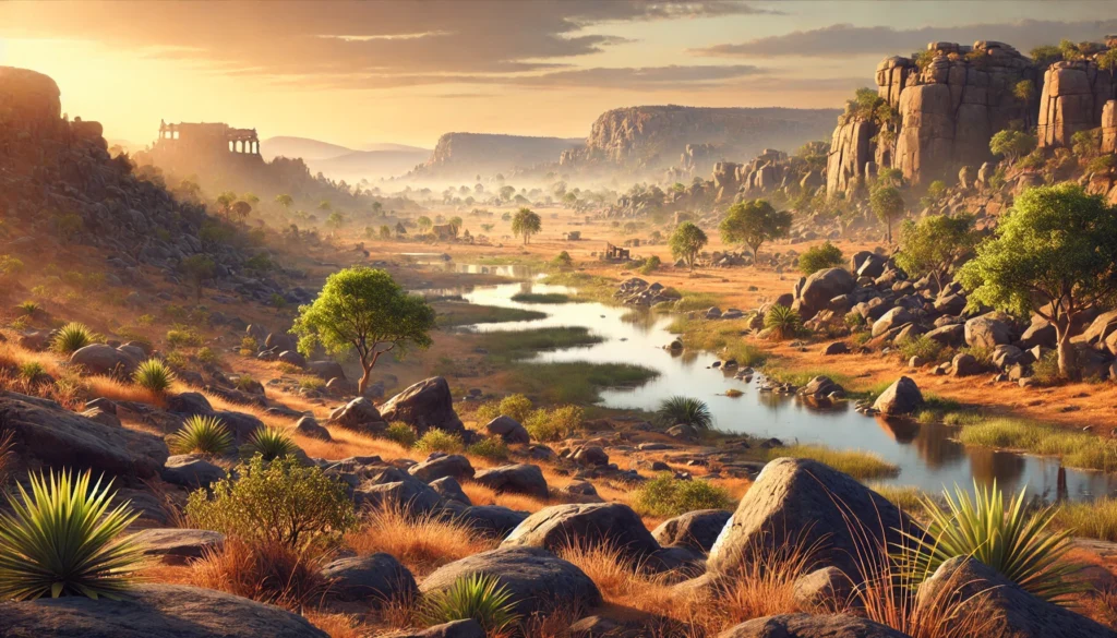
4. Deccan Plateau
Location
The Deccan Plateau is located in the southern part of India.
Characteristics
- This area is made up of hard rocks and high plateaus.
- Important rivers such as the Narmada, Godavari, Kaveri, and Krishna flow in and around this region.
- Red and laterite soils are commonly found in this area.
Importance
The Deccan Plateau is important for minerals and energy resources. It supports agriculture, mining, and many industrial activities that are vital for India’s economy.
5. Western and Eastern Ghats
Location
The Western and Eastern Ghats are located along the western and eastern coastal parts of India.
Characteristics
- The Western Ghats are high mountain ranges covered with dense forests.
- The Eastern Ghats are comparatively lower in height and are broken and fragmented ranges.
Importance
Both the Ghats are very important for the monsoon system and forest wealth. They are rich in biodiversity, water resources, and support many wildlife sanctuaries and plantations.
6. Coastal Areas
Location
India has two main coastal stretches:
- The western coast along the Arabian Sea.
- The eastern coast along the Bay of Bengal.
Characteristics
- The western coast is generally narrow and rocky.
- The eastern coast is wide and relatively flat.
- Important coastal regions and features include the Sunderbans, Chilika Lake, and Goa.
Importance
The coastal areas are important for fisheries, ports, trade, and tourism. They connect India with the world through sea routes and support many coastal communities.
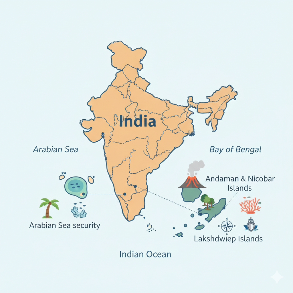
7. Andaman and Nicobar and Lakshadweep Islands
Location
These islands are located in the Bay of Bengal and the Arabian Sea.
Characteristics
- The Andaman and Nicobar Islands are known for their dense forests, rich biodiversity, and beautiful beaches.
- Lakshadweep is made up of small coral islands surrounded by the sea.

Best Selling Amazon Product
High quality, reliable performance and excellent customer satisfaction. Perfect for daily use.
Buy on AmazonImportance
These islands are important for biodiversity, marine life, and tourism. They also have strategic importance for India’s security and maritime activities.
Geographical Extent of India
India’s geographical extent can be defined using latitude, longitude, area, and the length of its coastline:
- Latitude: 8°4′ N to 37°6′ N
- Longitude: 68°7′ E to 97°25′ E
- Area: 32,87,263 square kilometres
- Coastline: Approximately 7,516.6 kilometres
Conclusion: How India’s Geography Shapes Its Identity
In short, India’s geographical area deeply influences its climate, culture, and economic activities. From the snowy Himalayan peaks to the hot Thar Desert, from the fertile Gangetic plains to the rich coastal belts and islands, every region has its own role and importance. This diversity makes India one of the most unique countries in the world.
When we understand these regions together, we see how India’s physical geography not only defines its map, but also shapes the daily life, livelihoods, and future possibilities of its people.
Frequently Asked Questions (FAQs) on the Geographical Area of India
Q1. What is the total geographical area of India?
The total geographical area of India is about 32,87,263 square kilometres. This makes India one of the largest countries in the world in terms of land area.
Q2. How many major physical regions are there in India?
Broadly, India can be divided into seven major physical regions: the Himalayan region, the Gangetic–Brahmaputra plains, the Thar Desert, the Deccan Plateau, the Western and Eastern Ghats, the coastal areas, and the island groups (Andaman and Nicobar and Lakshadweep).
Q3. Why is the Himalayan region important for India?
The Himalayan region is important because it acts as a natural barrier, influences the climate, and is the source of many major rivers. It also supports rich forests, biodiversity, and tourism, and protects northern India from cold winds and invasions in the past.
Q4. Why are the Gangetic–Brahmaputra plains called the “granary of India”?
The Gangetic–Brahmaputra plains are called the “granary of India” because the soil here is very fertile, the region has abundant water, and it supports intensive agriculture. A large part of India’s food grains are produced in these plains.
Q5. How does India’s geography influence its culture and economy?
India’s diverse geography has created different ways of living, languages, foods, clothes, and festivals in different regions. Economically, fertile plains support agriculture, plateaus support mining and industries, coasts support trade and fisheries, and mountains and islands support tourism and biodiversity. Together, these features make India’s culture rich and its economy varied.
Hilly Region (Himalayan Region)
The Himalayan region is one of the most important geographical divisions of India. From my understanding of India’s physical geography, the Himalayas are not just a chain of mountains, but a living system that deeply influences India’s climate, biodiversity, water resources, and cultural identity. Being the highest mountain region in the world, the Himalayas play a decisive role in shaping life across the Indian subcontinent.
Introduction to the Himalayas
The word Himalaya is derived from the Sanskrit words “him” (snow) and “ālaya” (home), which together mean “the abode of snow.” This majestic mountain range forms a natural boundary between the Indian subcontinent and the Tibetan Plateau, acting as both a physical and climatic barrier.
Geography of the Himalayas
- Length: Approximately 2,400 kilometres
- Width: About 400 km in the Kashmir region to nearly 150 km in Arunachal Pradesh
- Extent: The Himalayas extend across India, Nepal, Bhutan, and China (Tibet)
Classification of the Himalayas
The Himalayas can be divided into three main physiographic divisions based on height, structure, and geological features:
1. Greater Himalayas (Himadri)
Location: The northernmost and highest part of the Himalayan system.
Characteristics:
- Contains the world’s highest mountain peaks such as Mount Everest (8,848 m), Kanchenjunga (8,586 m), and Nanda Devi (7,816 m).
- Permanent snow cover and large glaciers are found throughout the year.
- Major rivers of India like the Ganges, Yamuna, Brahmaputra, and Sutlej originate from these glaciers.
Importance:
The Greater Himalayas act as the primary source of freshwater for India, supplying water to rivers that sustain agriculture, settlements, and industries across the plains.
2. Middle Himalayas (Himachal)
Location: Situated between the Greater Himalayas and the Shivalik ranges.
Characteristics:
- Altitude ranges from about 3,000 metres to 4,500 metres.
- Includes famous hill stations and tourist destinations such as Shimla, Mussoorie, Nainital, and Darjeeling.
- Dense forests are common, with cedar, pine, and oak being the dominant trees.
Importance:
- The region is suitable for agriculture and animal husbandry.
- Due to its moderate climate, a large population resides here.

Top Quality Amazon Product
Compact, useful and trusted Amazon product with excellent performance and long-lasting quality.
Buy on Amazon3. Shivalik Range (Outer Himalayas)
Location: The southernmost and outermost range of the Himalayas.
Characteristics:
- Altitude ranges between 900 metres and 1,200 metres.
- Includes small hills and sloping plains known as Doon, such as Dehradun and Katra.
- High soil erosion due to loose rock structure.
Importance:
- The soil in this region is fertile and supports agriculture.
- Several small and medium-sized streams flow through this area.
Himalayan Ecosystem
Flora and Fauna
Vegetation:
Vegetation in the Himalayas changes with altitude. Tropical forests are found in the lower regions, temperate forests in the middle ranges, and alpine grasslands at higher altitudes.
Wildlife:
The Himalayan region is home to rare and endangered species such as the snow leopard, musk deer, Himalayan bear, monal (state bird of Uttarakhand), and red panda.
Climate Influence
The Himalayas play a crucial role in diversifying India’s climate. They block cold, dry winds from Central Asia and force the monsoon winds to shed rainfall within India. Temperature and rainfall vary greatly due to altitude and geographical location.
Economic Importance of the Himalayas
Water Resources
Himalayan rivers form the backbone of India’s agriculture and drinking water supply. Major hydroelectric projects such as the Bhakra Nangal and Tehri Dam are built on these rivers.
Minerals and Forest Resources
Minerals like limestone and marble are found in the Himalayan region. The forests are rich in timber and medicinal plants, supporting both local livelihoods and industries.
Agriculture
Terrace farming is commonly practiced on mountain slopes. Major crops include rice, maize, potatoes, and fruits such as apples.
Tourism
The Himalayas are famous for hill stations, trekking, mountaineering, and important religious sites like Amarnath, Kedarnath, and Badrinath, making tourism a major economic activity.
Cultural and Religious Significance of the Himalayas
The Himalayan region holds deep religious and spiritual importance. Rivers like the Ganga, Yamuna, and the mythical Saraswati are considered sacred in Hinduism. The region is also a major centre of Tibetan Buddhism and diverse tribal cultures, reflecting a rich cultural heritage shaped by geography.
Challenges of the Himalayan Region
- Landslides and Earthquakes: The region is geologically young and highly prone to earthquakes and landslides.
- Climate Change: Rapid melting of glaciers poses a serious environmental and water-security threat.
- Population Pressure: Excessive agriculture, deforestation, and tourism are disturbing the ecological balance.
Conclusion
The Himalayas are not only India’s natural wealth but also a region of immense historical, cultural, and economic importance. From sustaining rivers and climate to nurturing spiritual traditions, the Himalayas support life far beyond their slopes. Their conservation and responsible management require special attention so that their natural beauty and invaluable resources can be preserved for future generations.
Gangetic – Brahmaputra Plain
The Gangetic–Brahmaputra Plain is one of the most fertile and densely populated regions of India. It is often referred to as the “granary of India” because of its vast agricultural output. From my understanding of Indian geography, this plain forms the backbone of India’s economic, cultural, and social structure due to its flat terrain, fertile alluvial soil, and the presence of major rivers.
Geographical Location
- Location: Spread across the northern and eastern parts of India and extending into Pakistan and Bangladesh.
- Extent: From the foothills of the Himalayas in the north to the edge of the Deccan Plateau in the south.
- Length: Approximately 2,400 kilometres.
- Width: About 320 km in the west and nearly 150 km in the east.
- Area: Around 7 lakh square kilometres.
The Gangetic–Brahmaputra Plain is formed by sediments such as sand, silt, and clay brought down by the Ganga, Brahmaputra, and their tributaries from the Himalayan mountains. Over millions of years, continuous deposition of these sediments created this vast plain.
The soil of this region is highly fertile and is known as alluvial soil, making it ideal for intensive agriculture.
Division of the Gangetic – Brahmaputra Plain
The Gangetic–Brahmaputra Plain can be broadly divided into three major parts:
1. Western Part (Gangetic Plains)
Location: Punjab, Haryana, Uttar Pradesh, Bihar, and West Bengal.
Characteristics:
- Irrigated by the Ganges and its tributaries such as the Yamuna, Ghaghara, Gandak, and Kosi.
- The land is extremely flat and fertile.
- Major crops include wheat, rice, sugarcane, and pulses.
- The region is culturally significant with historic cities like Varanasi, Prayagraj, and Patna.
2. Central Part (Brahmaputra Plains)
Location: Assam and parts of North-Eastern India.
Characteristics:
- Drained by the Brahmaputra River and its tributaries such as the Teesta, Manas, and Lohit.
- The region is flood-prone and experiences floods almost every year during the monsoon.
- Known for tea plantations, bamboo forests, and rich biodiversity.
- Important places include Kamakhya Temple and Kaziranga National Park.
3. Delta Region (Sundarban Delta)
Location: At the confluence of the Ganges and Brahmaputra rivers in West Bengal and Bangladesh.
Characteristics:
- The largest delta in the world.
- Home to the famous mangrove forests of the Sundarbans.
- Known for the Bengal tiger and rich aquatic life.
- Important for fisheries and rice cultivation.
Physical Features of the Ganges – Brahmaputra Plain
Soil and Agriculture
The soil in this region is alluvial, composed mainly of silt and mineral-rich deposits left by rivers. Crops such as wheat, rice, sugarcane, maize, and pulses are cultivated on a large scale, making this region the heart of India’s food production.
Network of Rivers
Numerous tributaries like the Yamuna, Ghaghara, Kosi, Son, Teesta, and Manas drain this region. These rivers help regulate climate, provide irrigation, and support inland transportation.
Flooding and Erosion
Flooding during the monsoon season is common and often causes damage to crops, property, and human life. Continuous erosion by rivers also leads to land degradation in several areas.
Biodiversity
The Sundarbans and the Brahmaputra Valley are major centres of biodiversity. Species such as the Bengal tiger, Ganges river dolphin, and a wide variety of migratory birds are found here.
Transport and Trade
Rivers act as important routes for transportation and trade. Cities like Kolkata, Varanasi, and Patna have developed as major commercial, cultural, and historical centres.
Economic and Cultural Importance
Agriculture
The Gangetic–Brahmaputra Plain is the main centre of food grain production in India. A well-developed irrigation system makes agriculture here more productive compared to many other regions.

Top Rated Amazon Product
Premium quality, reliable performance and excellent customer satisfaction. Perfect for everyday use.
Buy on AmazonIndustry
Industries such as sugar, textiles, and rice milling are prominent in this region. The Kolkata Port is one of the most important ports in India, supporting trade and industry.
Religious Significance
The river Ganges is considered sacred in Hinduism. Religious centres like the Sangam at Prayagraj and the city of Varanasi attract millions of pilgrims every year.
Tourism
Tourist destinations such as the Sundarbans, Kaziranga National Park, and historical cities of Uttar Pradesh promote both domestic and international tourism.
Problems of the Gangetic – Brahmaputra Plain
- Floods and Droughts: Frequent floods during the monsoon and droughts in the dry season cause major challenges.
- Environmental Degradation: Deforestation and pollution are damaging natural resources.
- Population Pressure: Dense population and rapid urbanisation are increasing pressure on land and water.
- Climate Change: Melting Himalayan glaciers and rising water levels are increasing long-term risks.
Conclusion
The Gangetic–Brahmaputra Plain is the centre of India’s economic, cultural, and natural wealth. Its fertile land and abundant water resources make it the backbone of the country. However, both natural and human-made threats pose serious challenges. Sustainable development and careful management of this region are essential for India’s long-term prosperity.

Desert Region (Thar Desert)
The Thar Desert, also known as the Great Indian Desert, is a vast and arid region located in the western part of India. From my understanding of India’s physical geography, the Thar Desert is not merely a barren land, but a region with unique geographical, ecological, economic, and cultural importance. Despite harsh climatic conditions, life here has adapted remarkably over centuries.
Geographical Location
- Location: Spread mainly over western Rajasthan, with parts extending into Haryana, Punjab, and Gujarat.
- International Extent: Extends into the Sindh and Punjab provinces of Pakistan.
- Area: Approximately 2,00,000 square kilometres.
- Boundaries:
- North: Sutlej River
- West: Indus River
- South: Rann of Kutch
- East: Aravalli Mountain Range
Physical Characteristics of the Thar Desert
Sand Dunes
Large sand dunes, locally known as Baluka Stupa, are a prominent feature of the Thar Desert. These dunes are constantly reshaped by strong winds, and their height can reach up to 500 metres in some areas.
Climate
The climate of the Thar Desert is dry and semi-arid.
- Summer temperatures can rise up to 50°C.
- Winter temperatures may fall below 0°C.
- Average annual rainfall ranges between 100–150 mm, most of which occurs during the monsoon season.
Soil
The soil of the Thar Desert is sandy with low water-holding capacity. It contains a high amount of calcium carbonate, making agriculture difficult without irrigation.
Flora and Fauna
Vegetation mainly includes shrubs, thorny plants, and trees such as acacia. The desert supports wildlife like camels, desert foxes, the Great Indian Bustard, and several species of lizards that are well adapted to arid conditions.
Major Rivers and Water Sources
Luni River
The Luni River is the main river of the Thar Desert. It originates from the Aravalli range and is an ephemeral river whose water usually disappears into the desert.
Oases
Water in the Thar Desert is also available in the form of oases. Several oases are found near regions like Jaisalmer and Barmer, supporting local settlements.
Indira Gandhi Canal
The Indira Gandhi Canal has transformed parts of the Thar Desert by providing irrigation water. It brings water from the Harike Barrage in Punjab, enabling agriculture and settlement in arid areas.
Ecological Importance of the Thar Desert
Biodiversity
The Thar Desert supports unique plant and animal species that have adapted to extreme dryness. The critically endangered Great Indian Bustard is one of the most notable species found here.
Vegetation and Adaptations
Plants such as Kikar and Acacia have deep root systems and the ability to conserve water, allowing them to survive long drought periods.
Economic Importance of the Thar Desert
Agriculture
Crops like millet, sorghum, and peanuts are grown depending on rainfall. In areas irrigated by the Indira Gandhi Canal, wheat and sugarcane are also cultivated.
Mineral Resources
Minerals such as limestone, phosphorite, and gypsum are found in the Thar region. The Jaisalmer area is also known for natural gas reserves.
Animal Husbandry
Animal rearing is an important occupation. Sheep, goats, cows, and especially camels are reared here. The camel is famously known as the “ship of the desert.”
Tourism
The Thar Desert attracts tourists from across the world. Cities like Jaisalmer, Jodhpur, and Bikaner are famous for desert safaris, camel rides, forts, and cultural festivals.
Energy Production
Due to high solar radiation and strong winds, the Thar Desert has emerged as a major centre for solar and wind energy production.
Cultural Significance of the Thar Desert
Folk Culture
The Thar Desert is the heart of Rajasthan’s rich folk culture. Folk music traditions like Manganiyar and Langas, dances such as Kalbelia, and vibrant handicrafts are key cultural symbols of this region.
Festivals and Fairs
Festivals like Maru Mahotsav celebrate desert culture through music, dance, and camel races. The Pushkar and Nagaur fairs also showcase the cultural heritage of the Thar region.
Top Rated Amazon Product
Premium quality, reliable performance and excellent customer satisfaction. Perfect for everyday use.
Buy on AmazonProblems of the Thar Desert
- Desertification: Overgrazing and limited vegetation are leading to land degradation.
- Water Crisis: Scarcity of water and overuse of available resources are major concerns.
- Population Pressure: Increasing population is placing additional pressure on natural resources.
- Floods: Abnormal monsoon patterns sometimes cause flooding in certain areas.
Conservation Measures
- Afforestation: Planting trees can help prevent desertification.
- Water Management: Efficient use of canals, ponds, and rainwater harvesting is essential.
- Ecological Balance: Conservation of wildlife and protection of native flora are necessary.
Conclusion
The Thar Desert is unique in its natural, economic, and cultural significance. Although the region faces serious environmental and resource-related challenges, sustainable development and conservation efforts can transform it into a centre of growth and prosperity. Its biodiversity, resilience, and cultural heritage continue to reflect the pride and diversity of India.
Deccan Plateau
The Deccan Plateau is a vast and ancient plateau region located in the southern part of India. From my study of Indian geography, this region stands out as one of the most important physical divisions of the country. It plays a crucial role in shaping India’s climate, agriculture, mineral wealth, cultural traditions, and economic development. Formed millions of years ago, the Deccan Plateau represents the geological and cultural depth of India.
Geographical Location and Extent
- Location: Situated in the southern part of India.
- Boundaries:
- North: Vindhya and Satpura mountain ranges
- West: Western Ghats
- East: Eastern Ghats
- South: Nilgiri Hills
- Area: Approximately 14 lakh square kilometres, covering about 43% of India’s total area.
- States Covered: Maharashtra, Karnataka, Telangana, Andhra Pradesh, Tamil Nadu, and parts of Kerala.
Geological Structure and Origin
The Deccan Plateau is a part of the ancient Gondwana land. It was formed mainly due to extensive volcanic activity around 65 million years ago. Layers of basalt rocks were created by lava flows, which later gave rise to fertile black soil.
Geologically, it is one of the oldest landforms of India and provides valuable evidence of the Earth’s ancient history.
Elevation and Topographical Features
- Average Height: 600–900 metres above sea level, exceeding 1,000 metres in some places.
- Slope: The plateau slopes gently from west to east, influencing the direction of river flow.
Main Topographical Divisions
- Western Ghats (Sahyadri Hills): The western edge of the plateau near the Arabian Sea. These ranges are higher, continuous, and play a major role in influencing the Indian monsoon.
- Eastern Ghats: The eastern boundary of the plateau, lower in height and more fragmented than the Western Ghats.
- Inter-Valley Region: The central plateau area between the Western and Eastern Ghats, consisting of fertile plains and forested regions.
Rivers and Water Resources
Due to the eastward slope of the plateau, most rivers flow towards the Bay of Bengal.
- Major East-Flowing Rivers: Godavari, Krishna, Kaveri, Tungabhadra, Pennar, and Mahanadi.
- Major West-Flowing Rivers: Narmada, Tapi, Mahi, and Sabarmati.
Several important multipurpose river valley projects such as Nagarjuna Sagar, Srisailam, and Koyna have been developed for irrigation and hydroelectric power generation.
Soil and Agriculture
Types of Soil
- Black Soil (Regur Soil): Found mainly in Maharashtra and central parts; ideal for cotton cultivation.
- Red Soil: Common in Tamil Nadu, Karnataka, and Andhra Pradesh; relatively low in organic matter.
- Laterite Soil: Found along the Western and Eastern Ghats; suitable for tea and coffee plantations.
Main Crops
The Deccan Plateau supports diverse agriculture. Major crops include cotton, jowar, bajra, rice, sugarcane, groundnut, pulses, and spices. Tea, coffee, and spices are especially important in the Western Ghats region.
Climate and Vegetation
Climate
- Climate Type: Tropical
- Summer Temperature: 35–40°C
- Winter Temperature: 10–25°C
- Annual Rainfall: 400–700 mm
Vegetation
Dense tropical evergreen forests are found in the Western Ghats, while the Eastern Ghats have deciduous forests and scrub vegetation. Common trees include teak, rosewood, acacia, and bamboo.
Mineral Resources
The Deccan Plateau is rich in mineral resources that support India’s industrial growth.
- Major Minerals: Iron ore, manganese, bauxite, limestone, gold, and diamonds.
- Important Mining Areas: Kolar Gold Fields (Karnataka) and iron ore belts of central India.

Premium Amazon Product
Stylish design, strong build quality and trusted performance. A perfect choice for daily needs.
Buy on AmazonEconomic and Cultural Importance
Industry
The Deccan Plateau is a major centre of industrialization. Cities like Bengaluru, Hyderabad, Pune, and Chennai are hubs for IT, automobile manufacturing, biotechnology, textiles, and food processing industries.
Tourism
The region attracts tourists for its historical monuments and natural beauty. Important tourist sites include Ajanta–Ellora Caves, Hampi, Belur–Halebidu, Mysore, and the Nilgiri Hills.
Cultural Heritage
The Deccan Plateau is the heart of Dravidian civilisation and architecture. Classical art forms such as Bharatanatyam and Carnatic music originated here and continue to influence Indian culture globally.
Problems and Challenges of the Deccan Plateau
- Water Crisis: High dependence on monsoon rainfall and frequent droughts.
- Soil Erosion: Caused by deforestation, overgrazing, and improper farming practices.
- Urbanisation Pressure: Rapid urban and industrial growth is stressing natural resources.
- Uneven Development: Some areas are highly developed while others remain economically backward.
Conservation and Sustainable Development Measures
- Water Conservation: Efficient management of irrigation projects and groundwater recharge.
- Forest Conservation: Afforestation and protection of wildlife habitats.
- Sustainable Agriculture: Promotion of organic farming and drought-resistant crops.
- Balanced Development: Equitable growth of rural and urban regions.
Conclusion
The Deccan Plateau is one of India’s most important geographical, economic, and cultural regions. Its ancient geological structure, rich mineral resources, agricultural diversity, and vibrant cultural heritage make it unique. While the region faces challenges such as water scarcity and environmental degradation, a balanced approach between development and conservation can ensure sustainable growth and long-term prosperity for the Deccan Plateau.
Western and Eastern Ghats
The Western and Eastern Ghats, located in the southern part of India, are extremely important for the country’s geography, climate, agriculture, and biodiversity. These mountain ranges surround the Deccan Plateau and play a crucial role in maintaining ecological balance and influencing monsoon patterns.
Western Ghats
Geographical Location
- Pass through Maharashtra, Goa, Karnataka, Kerala, and Tamil Nadu.
- Extend from the Tapi River basin in Gujarat to the Nilgiri Hills in the south.
- Total Length: About 1,600 km
- Average Altitude: 900–1,600 metres
- Highest Peak: Anaimudi Peak (2,695 m), Kerala
Physical Characteristics
- Mountain range runs parallel to the western coast.
- Steep slope towards the Arabian Sea and gentle slope towards the Deccan Plateau.
- Acts as a climatic barrier.
Effect on Climate
The Western Ghats obstruct the southwest monsoon winds, causing heavy rainfall on the western side. This makes the western coastal region fertile and supports dense forests.
Rivers
Many important rivers originate from the Western Ghats, including the Godavari, Krishna, Kaveri, and Tungabhadra.
Vegetation and Biodiversity
- Tropical evergreen and semi-evergreen forests.
- Declared a UNESCO World Heritage Site.
- A major biodiversity hotspot.
- Animals include Asian elephant, Indian tiger, gaur, and rare bird species.
National Parks and Sanctuaries
Silent Valley (Kerala), Bandipur (Karnataka), and Periyar (Kerala).
Economic Importance
- Agriculture: Tea, coffee, spices, and cardamom cultivation.
- Minerals: Iron ore and bauxite deposits.
- Water & Energy: Hydroelectric projects like Koyna and Idukki dams.
Eastern Ghats
Geographical Location
- Pass through Odisha, Andhra Pradesh, Tamil Nadu, and West Bengal.
- Located parallel to the Bay of Bengal.
- Total Length: About 1,700 km
- Average Height: 600–900 metres
- Highest Peak: Jindagada Peak (1,690 m), Araku Valley, Andhra Pradesh
Physical Characteristics
- More fragmented and discontinuous than the Western Ghats.
- River valleys formed by Mahanadi, Godavari, and Kaveri.
- Gentle slope towards the Bay of Bengal.
Effect on Climate
The Eastern Ghats receive comparatively less rainfall. The influence of monsoon clouds is weaker than in the Western Ghats.
Vegetation and Biodiversity
- Dry and semi-evergreen forests.
- Wildlife includes tiger, leopard, and spotted deer.
- Important habitat for birds and reptiles.
National Parks and Sanctuaries
Similipal (Odisha) and Araku Valley (Andhra Pradesh).
Economic Importance
- Agriculture: Rice, maize, and sugarcane cultivation.
- Minerals: Coal, bauxite, and limestone.
- Water Management: Hirakud Dam (Mahanadi) and Polavaram Project (Godavari).
Comparative Study: Western Ghats vs Eastern Ghats
| Feature | Western Ghats | Eastern Ghats |
|---|---|---|
| Location | Parallel to the west coast | Parallel to the Bay of Bengal |
| Average Height | 900–1600 metres | 600–900 metres |
| Length | 1600 km | 1700 km |
| Structure | Continuous and organized | Fragmented and discontinuous |
| Rainfall | Heavy rainfall | Relatively low rainfall |
| Vegetation | Evergreen and semi-evergreen forests | Dry and deciduous forests |
| Biodiversity | Very high (hotspot) | Moderate |
| Economic Focus | Spices, tea, coffee, hydropower | Rice, minerals, irrigation |
Conservation Challenges
- Western Ghats: Urbanisation, deforestation, dam construction, biodiversity loss.
- Eastern Ghats: Mining, industrialisation, deforestation, and poaching.
Conclusion
The Western and Eastern Ghats are vital for India’s ecological stability, climate regulation, and economic development. Their forests, rivers, and biodiversity sustain millions of lives. Preserving these mountain systems through sustainable practices and community participation is essential for maintaining India’s natural balance.
Coastal Regions of India
India’s coastal region is a vital part of the country’s geography, climate, trade, and cultural diversity. With a total coastline of about 7,516.6 km, including island territories, coastal areas are rich in natural resources, ports, and diverse ecosystems.
Geographical Location and Distribution
- Mainland coastline: About 6,100 km
- Arabian Sea to the west
- Bay of Bengal to the east
- Indian Ocean to the south
Coastal States and Union Territories
- West Coast: Gujarat, Maharashtra, Goa, Karnataka, Kerala
- East Coast: West Bengal, Odisha, Andhra Pradesh, Tamil Nadu
- Islands: Andaman & Nicobar Islands, Lakshadweep
Physical Characteristics
Western Coast
- Narrow and steep coastline
- Bays, lagoons, and Kerala backwaters
- Major ports: Mumbai, Kandla, Mangaluru
Eastern Coast
- Wide and flat coastline
- Large river deltas (Mahanadi, Godavari, Kaveri)
- Major ports: Chennai, Visakhapatnam, Paradip
Climate and Ecosystem
- Tropical marine climate
- Rainfall: 1000–3000 mm
- Temperature: 20–35°C
Mangroves, coral reefs, lagoons, and marine biodiversity such as sea turtles, dolphins, and dugongs are key ecological features.

Top Quality Amazon Product
Premium build quality, reliable performance and excellent customer satisfaction. Ideal for everyday use.
Buy on AmazonEconomic Importance
- Fisheries: Major fish production zone
- Agriculture: Rice, coconut, spices, sugarcane
- Trade: Major maritime trade hubs
- Tourism: Goa, Kerala, Puducherry, Andaman & Nicobar
Problems and Conservation
- Sea-level rise and coastal erosion
- Cyclones and storms
- Marine pollution
- Need for mangrove and coral conservation
Final Conclusion
India’s Western and Eastern Ghats along with its coastal regions form the backbone of the country’s ecological and economic systems. Protecting these regions through sustainable development, strong environmental policies, and community involvement is essential for India’s future growth and environmental security.
Andaman & Nicobar and Lakshadweep Islands
The Andaman and Nicobar Islands and the Lakshadweep Islands are India’s major oceanic island territories. These islands form an important part of India’s maritime domain and hold great significance for national security, biodiversity, tourism, and cultural diversity. Although both are island groups, they are geographically, ecologically, and culturally very different from each other.
1. Andaman and Nicobar Islands
Geographical Location
- Located in the south-eastern part of the Bay of Bengal.
- Stretch over nearly 800 km from north to south.
- Total islands: 572 (around 37 are inhabited).
- Major island groups: Andaman Islands and Nicobar Islands.
- The 10° Channel separates the Andaman group from the Nicobar group.
- Total area: 8,249 sq. km.
- Important islands: Port Blair (capital), Havelock Island, Baratang, Car Nicobar, Great Nicobar.
Physical Characteristics
- Formed mainly of volcanic rocks and coral reefs.
- Barren Island, India’s only active volcano, is located here.
- Dense tropical evergreen forests cover large areas.
- Rich marine ecosystems including coral reefs and mangrove forests.
Climate and Population
- Climate: Tropical marine.
- Temperature range: 23°C to 31°C.
- Population: Around 4 lakh.
- Indigenous tribes such as the Nicobari and other tribal communities live here.
Economic and Cultural Importance
- Tourism: Havelock Island and Radhanagar Beach are world famous; scuba diving and snorkeling are popular.
- Security: Plays a strategic role in defending India’s south-eastern maritime border.
- Agriculture & Fisheries: Coconut, betel nut, spices, and fishing are major activities.
2. Lakshadweep Islands
Geographical Location
- Located in the Arabian Sea.
- About 200–400 km off the Kerala coast.
- Total islands: 36 (10 inhabited).
- Major islands: Kavaratti (capital), Agatti, Minicoy.
- Total area: About 32 sq. km.
- Smallest Union Territory of India.
Physical Characteristics
- Entirely made up of coral reefs.
- Surrounded by shallow lagoons and saltwater lakes.
- Coconut trees dominate the vegetation.
- Rich marine life including turtles, dolphins, and coral fish.
Premium Amazon Product
High quality, stylish design and trusted performance. Perfect choice for daily and professional use.
Buy on AmazonClimate and Population
- Climate: Tropical marine.
- Temperature range: 25°C to 35°C.
- Population: Approximately 70,000.
- Population mainly belongs to the Muslim community.
Economic and Cultural Importance
- Tourism: Cruise tourism, scuba diving, kayaking in Agatti and Kavaratti.
- Agriculture & Fisheries: Coconut cultivation and fishing are main livelihoods.
- Strategic Importance: Key to India’s maritime security in the Arabian Sea.
Comparative Study: Andaman & Nicobar vs Lakshadweep
| Feature | Andaman & Nicobar Islands | Lakshadweep Islands |
|---|---|---|
| Location | Bay of Bengal | Arabian Sea |
| Total Islands | 572 | 36 |
| Area | 8,249 sq. km | 32 sq. km |
| Population | ~4 lakh | ~70,000 |
| Capital | Port Blair | Kavaratti |
| Natural Structure | Volcanic and coral reefs | Only coral reefs |
| Strategic Role | South-eastern maritime defence | Security of Arabian Sea |
Key Challenges
- Andaman & Nicobar: Environmental degradation, tourism-related pollution, and threats to indigenous tribes.
- Lakshadweep: Rising sea levels, coral reef degradation, and limited economic opportunities.
Conservation and Development Measures
- Protection of coral reefs and marine biodiversity.
- Control of plastic and marine pollution.
- Promotion of eco-friendly and sustainable tourism.
- Involvement of local communities in development.
- Strengthening maritime infrastructure and security.
Conclusion
The Andaman & Nicobar and Lakshadweep Islands are integral to India’s natural, cultural, and strategic framework. Their rich biodiversity, unique cultures, and strategic locations make them extremely valuable. However, environmental pressure and climate-related challenges demand a development approach that balances economic growth with ecological sustainability.
Geographical Extent of India
India is a vast country located in South Asia and is known for its remarkable geographical diversity. From the Himalayas in the north to the Indian Ocean in the south, and from deserts to fertile plains, India’s geography shapes its climate, culture, economy, and global importance.
Geographical Location
- Located in the Northern Hemisphere.
- Latitude: 8°4′ N to 37°6′ N.
- Longitude: 68°7′ E to 97°25′ E.
- The Tropic of Cancer passes almost through the middle of India.
Area and Size
- Total area: 32,87,263 sq. km.
- About 2.4% of the world’s total land area.
- Total coastline: 7,516.6 km (including islands).
- North–South extent: 3,214 km.
- East–West extent: 2,933 km.
Neighbouring Countries
- North: China, Nepal, Bhutan.
- West: Pakistan, Afghanistan.
- East: Bangladesh, Myanmar.
- South (across sea): Sri Lanka and Maldives.
Major Physical Regions
- Himalayan Mountain Region
- Ganga–Brahmaputra Plains
- Deccan Plateau
- Coastal Plains
- Thar Desert
- Island Groups
Conclusion
The geographical extent of India defines its natural beauty, economic potential, cultural diversity, and strategic strength. Protecting this geographical richness through sustainable development and environmental balance is essential for India’s long-term growth and global role.