
Historical and Cultural Perspective
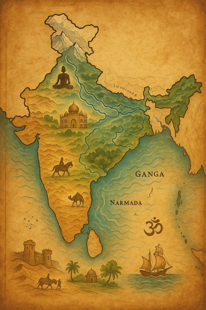
India’s Geographic Significance has never been a passive background; it has been an active architect of its history, economy, and culture. From the fertile plains of the Indus Valley Civilization to the trade-rich coastal kingdoms and the modern nation-state, India’s terrain has continuously shaped patterns of settlement, governance, and belief. Rivers nurtured agriculture and urban growth, mountains offered security and isolation, while coastlines opened doors to maritime trade and cultural exchange. Geography thus became the silent yet most influential force in India's civilizational evolution.
The geography of India has never been a passive background; it has been an active architect of its history, economy, and culture. From the fertile plains of the Indus Valley Civilization to the trade-rich coastal kingdoms and the modern nation-state, India’s terrain has continuously shaped patterns of settlement, governance, and belief. Rivers nurtured agriculture and urban growth, mountains offered security and isolation, while coastlines opened doors to maritime trade and cultural exchange. Geography thus became the silent yet most influential force in India's civilizational evolution.
Religion and cultural practices have been deeply intertwined with geographical features. The Ganga, Yamuna, and Narmada rivers are not merely water bodies — they are sacred entities that sustain faith as much as they sustain life. Rituals like holy bathing, pilgrimages, and seasonal festivals arose from the cycles of nature governed by these rivers. The Himalayas, with their snow-clad peaks, became symbols of divinity and endurance, inspiring spiritual reflection and mythological reverence. Similarly, the coastal regions nurtured maritime communities whose festivals, occupations, and folklore echoed the rhythm of the sea.
This spiritual and cultural evolution further reflects India’s Geographic Significance in shaping faith, identity, and social traditions across centuries.
Geography also determined political boundaries and the nature of governance. Mountain ranges such as the Himalayas and the Aravallis acted as natural fortresses, protecting territories from invasions while fostering unique regional cultures. In contrast, fertile river valleys — like those of the Ganga and Godavari — supported dense populations, giving rise to centralized kingdoms and complex administrative systems. Coastal access transformed regions like Gujarat, Kerala, and Tamil Nadu into trade hubs that linked India to Africa, the Middle East, and Southeast Asia. Through these exchanges, India absorbed new languages, foods, and ideas while also exporting its spices, textiles, and philosophies.
The diversity of India’s geography led to cultural diversity. People living in the Himalayan foothills developed distinct agricultural and dietary practices compared to those on the plains. In the fertile Gangetic region, surplus crops allowed the growth of cities, crafts, and organized governance. In the south, the monsoon-fed coastal belt produced spices, coconuts, and maritime industries, making it a global center for trade and cultural dialogue. Every terrain encouraged adaptation — shaping dialects, art forms, and local customs that still endure.
Geography also influenced conflict, strategy, and trade. The mountain passes of the northwest, such as the Khyber and Bolan, were conduits for both invasion and exchange. Empires rose and fell along these routes, each integrating local topography into their defense and expansion strategies. Forts were constructed on high ridges, cities emerged along navigable rivers, and trade caravans followed predictable paths shaped by geography. Coastal fortifications and ports like Lothal, Calicut, and Bombay stand today as reminders of how terrain dictated both vulnerability and opportunity.
These historical developments clearly demonstrate how India’s Geographic Significance influenced defense, trade networks, and imperial strategies.
Over centuries, the geographical mosaic of India cultivated resilience and pluralism in its people. Living amidst varied climates, resources, and ecological conditions taught communities how to coexist with difference. The coexistence of deserts and rainforests, glaciers and deltas, created not separation but synergy — a natural pluralism reflected in India’s languages, cuisines, music, and philosophies. Geography thus became both a challenge and a teacher, compelling adaptation and cooperation.
In conclusion, India’s historical and cultural evolution cannot be understood without understanding its geography. The rivers shaped livelihoods and faith, the mountains shaped defense and spirituality, and the coasts shaped exchange and innovation. Geography has been the silent scriptwriter behind India’s civilizational story — guiding where people lived, how they worshipped, what they traded, and how they connected with the world. In the following section, we will explore the core geographical features — the Himalayas, rivers, and coastlines — and analyze their continuing economic and strategic importance in modern India.
India’s Geographic Significance: The Himalayas, Rivers, Coastlines, and Plateaus
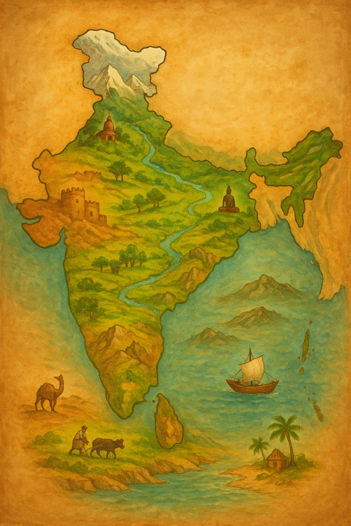
The geography of India is remarkable for its diversity and vastness. From the snow-clad peaks of the Himalayas in the north to the rolling coastlines of the south, from the fertile river plains to the rugged central plateaus, every region contributes uniquely to the country’s natural and cultural identity. These geographical features have not only defined India’s climate and ecosystems but have also influenced its agriculture, economy, trade, and strategic outlook. Together, they form the living foundation of the Indian subcontinent’s civilization.
India’s Geographic Significance is best understood through its diverse physical features. From the snow-clad peaks of the Himalayas in the north to the rolling coastlines of the south, from the fertile river plains to the rugged central plateaus, every region contributes uniquely to the country’s natural and cultural identity. These geographical features have not only defined India’s climate and ecosystems but have also influenced its agriculture, economy, trade, and strategic outlook. Together, they form the living foundation of the Indian subcontinent’s civilization.
The Himalayas: The Northern Shield
Stretching over 2,400 kilometers across the northern frontier, the Himalayas form a towering wall that separates the Indian subcontinent from Central Asia. These mountains, among the youngest and highest in the world, are both a symbol of strength and a source of life. The Himalayas give birth to the great perennial rivers — the Ganga, Yamuna, Brahmaputra, and Indus — that nurture millions of lives downstream. Beyond their scenic grandeur, they regulate India’s weather patterns by blocking cold winds from Central Asia and trapping the monsoon rains within the subcontinent.
Ecologically, the Himalayas are a biodiversity hotspot, home to rare flora and fauna and countless medicinal plants. Strategically, they serve as a natural defense barrier, historically protecting India from invasions. Yet, they are also fragile ecosystems vulnerable to climate change, deforestation, and glacial retreat. Sustainable tourism, afforestation, and transboundary water cooperation with neighboring countries are essential for preserving this crucial mountain system that sustains both India’s ecology and economy.
The protective and climatic role of the mountains clearly reflects India’s Geographic Significance in shaping security and environmental stability.
The Rivers: Lifelines of Civilization
The rivers of India have shaped both its geography and civilization. The northern rivers — Ganga, Yamuna, Ghaghara, and others — originate in the glaciers of the Himalayas and flow perennially, nourishing the fertile Indo-Gangetic plains. In contrast, the southern rivers like Godavari, Krishna, Kaveri, and Narmada arise from the peninsular plateau and depend on monsoon rains. These rivers sustain agriculture, industry, and domestic life while also carrying deep cultural and spiritual meaning.
The Ganga, often called the “Mother River,” has been at the heart of India’s religious and social consciousness for millennia. The river valleys have been cradles of civilization, supporting dense populations and urban growth. However, increasing pollution, over-extraction, and mismanagement now threaten their sustainability. Reviving traditional water management systems such as stepwells, tanks, and rainwater harvesting — combined with modern technology — is essential to ensure long-term water security. Rivers are not merely physical entities but dynamic ecosystems that must be respected and restored.
The river systems further strengthen India’s Geographic Significance by supporting agriculture, population growth, and cultural continuity.
The Coastline and Maritime Significance
India’s coastline stretches for about 7,500 kilometers, touching the Arabian Sea in the west and the Bay of Bengal in the east. These coastal regions are vital hubs of trade, industry, fisheries, and tourism. Major ports such as Mumbai, Kochi, Chennai, and Visakhapatnam are gateways to global commerce and engines of economic growth. The coastal plains are also rich in biodiversity — mangroves, coral reefs, and wetlands that buffer the land against cyclones and erosion.
From a strategic perspective, India’s maritime geography gives it a commanding position in the Indian Ocean. The Andaman and Nicobar Islands, situated near key sea lanes, are crucial for maritime security and trade surveillance. The concept of the “Blue Economy” — sustainable use of ocean resources — is increasingly shaping India’s coastal policies. Yet, these regions face growing threats: sea-level rise, coastal erosion, pollution, and unsustainable development. Protecting marine ecosystems while empowering coastal communities with modern livelihood opportunities is essential for maintaining balance between growth and conservation.
The Plateaus and Plains: The Core of India
The Deccan Plateau, covering most of southern and central India, forms the ancient geological heart of the subcontinent. It is a vast region of volcanic origin, rich in minerals such as coal, iron ore, bauxite, and manganese. This wealth has made the plateau an industrial powerhouse. Cities like Nagpur, Hyderabad, and Bengaluru have grown into centers of technology, trade, and innovation — illustrating how geography supports economic transformation.
The northern plains, formed by the alluvial deposits of the Ganga and Brahmaputra rivers, are among the most fertile agricultural regions in the world. Here, crops like rice, wheat, and sugarcane are cultivated in abundance, sustaining millions of farmers. In contrast, the western Thar Desert presents a stark yet vital landscape — traditionally dependent on animal husbandry and now emerging as a hub for renewable energy projects, particularly solar and wind power. This shows how even arid geographies can be harnessed sustainably through innovation and planning.
The plateau and plains together represent the dynamic interplay between natural endowment and human effort. The fertile valleys have given rise to dense civilizations, while the rocky plateaus have fostered resilience and enterprise. As India urbanizes and industrializes, maintaining ecological equilibrium in these regions is crucial to ensure that growth does not come at the cost of sustainability.
In essence, India’s geographical diversity is not just a matter of physical variation — it is the living framework upon which its economy, culture, and civilization have evolved. From the Himalayas to the coasts, and from rivers to deserts, each region contributes uniquely to the identity of the nation. This interlinked web of ecosystems, economies, and cultures makes India a microcosm of the world — where every terrain, every climate, and every resource exists in harmony. In the next section, we will explore how this geographical richness influences India’s climate, biodiversity, and environmental policies — shaping the challenges and opportunities of the future.
The Himalayas: Source, Shield, and Sensitive Ecosystem
The Himalayas are more than a mountain range; they are the living backbone of northern India. Stretching across the subcontinent’s northern frontier, these peaks feed the great perennial rivers — the Ganga, Yamuna, and Brahmaputra — and thus underpin the water security of hundreds of millions. They influence climate by blocking cold continental winds and shaping monsoon patterns that sustain agriculture across vast plains. Ecologically, the Himalayas host unique biodiversity and countless medicinal plants, while their forests stabilize slopes and regulate downstream sediment flows.
Strategically, the mountain chain has historically acted as a natural bulwark, defining borders and shaping defense thinking. Economically and culturally, Himalayan valleys support pastoral communities, terrace agriculture, and pilgrimage circuits that sustain local livelihoods. Yet the range is fragile: accelerating glacier retreat, increased landslides, deforestation, and unplanned tourism threaten its resilience. Addressing these pressures requires integrated approaches — transboundary river cooperation, community-led afforestation, sustainable tourism practices, and investments in early-warning and slope-stabilization technologies — so that the Himalayas continue to serve as source, shield, and sanctuary for generations to come.
Rivers and Water Management: Lifelines and Governance Challenges
Rivers are the circulatory system of India’s economy and culture. The perennial northern rivers nourished ancient civilizations and today support intensive agriculture, industry, and urban centres. Peninsular rivers, by contrast, are more seasonal and closely tied to monsoon rhythms. Across regions, rivers provide irrigation, drinking water, hydropower, and cultural identity — but their utility is under threat from pollution, over-extraction, poorly planned river engineering, and changing rainfall patterns.
Effective water management must blend traditional practices with modern science. Revival of tanks, stepwells and community ponds, coupled with watershed management, groundwater recharge, rainwater harvesting, and demand-side efficiency in irrigation, can restore hydrological balance. Institutional reforms are equally important: basin-scale planning, inter-state cooperation, transparent data sharing, and incentives for water-efficient crops and technologies. Importantly, rivers are living ecosystems; policies must prioritize ecological flows, pollution control, and riverfront conservation to secure long-term water security for both people and nature.
Coastline and Maritime Strategy: Economic Opportunity and Strategic Imperative
India’s long coastline and island territories give it critical maritime advantage in the Indian Ocean. Coastal ports are nodes of trade and industry, fisheries sustain millions of livelihoods, and marine ecosystems like mangroves and reefs provide natural storm protection and carbon sinks. Strategically, control of sea lanes and maritime awareness are central to national security and regional influence.
Balancing growth and conservation is key: sustainable port development, pollution control, community-based fisheries management, and coastal habitat restoration are essential. Strengthening maritime surveillance, investing in resilient coastal infrastructure, and integrating coastal communities into planning ensure that the coastline remains both an engine of prosperity and a line of defence.
India’s Geographic Significance in the Indian Ocean region enhances its maritime power and global trade connectivity.
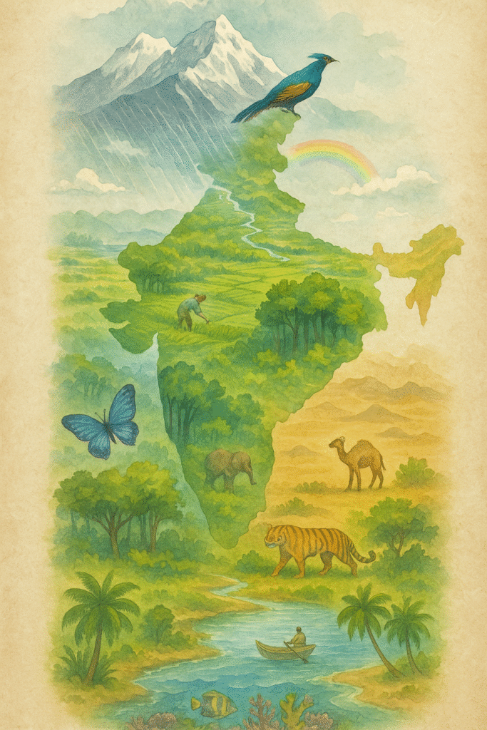
India’s Geographic Significance in Climate and Biodiversity
India’s Geographic Significance is clearly reflected in its diverse climate and extraordinary biodiversity. Spanning tropical, subtropical, temperate, and alpine zones within a single peninsula, India hosts a remarkable range of climatic regimes and ecosystems. The interaction between the monsoon system, the Himalayan rain shadow, coastal moisture, and varied topography has created microclimates that sustain unique flora and fauna across forests, wetlands, mangroves, coral reefs, grasslands, and alpine meadows. This ecological variety strengthens India’s Geographic Significance as a global biodiversity hotspot and underpins the livelihoods of millions.
The monsoon is central to understanding India’s Geographic Significance in shaping agricultural and ecological systems. The seasonal reversal of winds brings concentrated rainfall that supports rain-fed agriculture and replenishes groundwater. Regions such as the Western Ghats and the northeastern Himalaya receive heavy precipitation and sustain dense evergreen forests, while rain-shadow zones and the Thar Desert receive sparse rainfall and support drought-adapted ecosystems. These climatic contrasts have given rise to region-specific crops, traditional knowledge systems, and community-based water management practices.
Biodiversity enhances India’s Geographic Significance by providing essential ecosystem services — pollination, soil formation, water purification, carbon sequestration, and coastal protection. Mangrove belts buffer storm surges and reduce erosion; wetlands filter pollutants and store floodwaters; forests regulate local climates and sustain freshwater flows. Economically, biodiversity supports fisheries, forestry, agriculture, and ecotourism, contributing directly to rural incomes and national development. Culturally, many species and landscapes are woven into local rituals and medicinal systems, reinforcing conservation ethics across communities.
However, India’s Geographic Significance also faces serious environmental challenges. Rising temperatures, altered monsoon patterns, glacial retreat, and the increasing frequency of extreme events such as heatwaves, droughts, and cyclones are transforming habitats. Habitat fragmentation, pollution, invasive species, and unsustainable land use further weaken ecological resilience. Coral bleaching, mangrove loss, and declining endemic species populations highlight the urgency of integrated climate and biodiversity action.
Protecting India’s Geographic Significance requires integrated and forward-looking strategies. Nature-based solutions — including ecosystem restoration, mangrove afforestation, wetland conservation, and landscape connectivity — can strengthen resilience while promoting sustainable growth. Climate adaptation must align with biodiversity conservation through agroecological farming, watershed management, and well-managed protected-area networks that preserve ecological corridors.
Policy and governance are equally crucial. Strengthening environmental laws, expanding protected areas, integrating biodiversity into development planning, and supporting sustainable livelihoods can reduce pressure on fragile ecosystems. Scientific monitoring, citizen participation, and indigenous knowledge systems play a key role in ensuring long-term ecological balance and adaptive management.
In conclusion, India’s Geographic Significance in climate and biodiversity underscores the deep connection between environment, economy, and society. Safeguarding this natural wealth through coordinated action, modern science, and community engagement will ensure that India’s ecological heritage continues to sustain both present and future generations.

India’s Geographic Significance in Economic and Strategic Importance
India’s Geographic Significance is not merely a reflection of natural diversity; it is the foundation of the country’s economic development and strategic influence. The nation’s varied landforms, abundant natural resources, extensive river systems, and long coastline give India a unique geopolitical position that connects South Asia with the broader Indo-Pacific region. This strategic location strengthens India’s Geographic Significance in shaping trade routes, infrastructure networks, and regional stability.
Natural Resources and Economic Growth
India’s Geographic Significance is clearly visible in the distribution of its natural resources. The fertile plains of the north, enriched by the alluvial deposits of the Ganga and Brahmaputra, support intensive agriculture producing rice, wheat, sugarcane, and pulses — forming the backbone of food security. In contrast, the peninsular plateau is rich in mineral wealth including coal, iron ore, bauxite, manganese, and copper, powering India’s industrial base. States such as Jharkhand, Odisha, Chhattisgarh, and Karnataka have developed as major mining and manufacturing centers due to this geographical advantage.
In western India, arid regions like Rajasthan and Gujarat are emerging as renewable energy hubs because of abundant solar and wind potential. Coastal belts sustain fisheries, aquaculture, and port-based industries. This regional specialization reflects India’s Geographic Significance in creating a diversified and resilient economy where agriculture, industry, and services complement each other across ecosystems.
Transportation Networks and Spatial Connectivity
India’s Geographic Significance has also shaped its transportation and connectivity systems. The north-south and east-west corridors integrate distant regions into a unified national market. Rivers such as the Ganga and Brahmaputra serve as inland waterways, reducing logistics costs and enhancing trade efficiency. Mountain passes like Nathu La and Lipulekh act as strategic gateways for cross-border commerce and diplomatic engagement.
The Indo-Gangetic plains host dense railway and highway networks linking production centers with ports and consumption markets. Infrastructure initiatives such as Bharatmala and Sagarmala further demonstrate how India leverages its Geographic Significance to improve trade competitiveness and national security. These projects enhance regional integration while strengthening economic resilience.
Air connectivity complements this spatial integration. Major international airports in Delhi, Mumbai, Chennai, Kolkata, and Bengaluru connect India to global supply chains and investment flows. Together, these multimodal networks transform India’s Geographic Significance into a practical engine of economic growth.
Maritime Routes and Strategic Position
India’s Geographic Significance is particularly evident in its maritime position. With a coastline exceeding 7,500 kilometers and a central location in the Indian Ocean, India sits astride key sea lanes connecting the Middle East, Africa, and Southeast Asia. These routes carry a substantial share of global trade and energy supplies, giving India both economic opportunities and strategic responsibilities.
Island territories such as the Andaman and Nicobar Islands and Lakshadweep enhance India’s capacity to monitor vital sea lanes and respond to regional challenges. The Indian Navy’s role in maritime security, humanitarian assistance, and anti-piracy operations reflects how India’s Geographic Significance translates into regional influence in the Indo-Pacific.
Economically, the Blue Economy framework highlights India’s Geographic Significance in sustainable ocean resource management. Fisheries, offshore energy, coastal tourism, and port-led industrialization contribute to employment and growth. Responsible coastal policies ensure that economic expansion aligns with environmental protection.
Strategic Outlook and Future Direction
India’s Geographic Significance gives it a natural advantage in regional geopolitics. Policies such as Act East, Neighborhood First, and SAGAR leverage India’s location to enhance connectivity, stability, and economic cooperation across Asia and the Indian Ocean region. Land corridors like the International North-South Transport Corridor (INSTC) and maritime initiatives under the Indo-Pacific framework further integrate India into global trade networks.
In essence, India’s Geographic Significance lies in its balance of terrestrial resources and maritime strength. Fertile plains sustain agriculture, mineral-rich plateaus power industries, and expansive coastlines connect India to global commerce. By investing in sustainable resource management, resilient infrastructure, and strategic maritime capabilities, India can continue transforming its geographical advantage into long-term prosperity and security in the 21st century.

India’s Geographic Significance in Geographical Challenges and Solutions
India’s Geographic Significance is reflected not only in its strengths but also in the environmental challenges shaped by its diverse terrain and climate. Floods, droughts, and land degradation affect millions every year and highlight the complex relationship between natural systems and human activity. These interconnected challenges demonstrate how India’s Geographic Significance influences both vulnerability and resilience. Addressing them requires scientific planning, traditional wisdom, and strong community participation.
Floods: The Dual Face of Water Abundance
Floods in India are closely linked to monsoonal patterns and river systems, underscoring India’s Geographic Significance in water resource distribution. The Ganga, Brahmaputra, and their tributaries frequently overflow during heavy rainfall, inundating parts of Bihar, Assam, Uttar Pradesh, and West Bengal. While these rivers sustain agriculture and livelihoods, their excess flow can devastate crops, displace populations, and damage infrastructure.
Human activities such as encroachment on floodplains, deforestation, and unplanned urban expansion intensify flooding risks. Strengthening India’s Geographic Significance as a source of resilience requires scientific river basin management, wetland restoration, and flood-resilient infrastructure. Early warning systems, climate-smart urban planning, and ecological river rejuvenation projects can transform recurring disasters into manageable risks.
Drought: Water Scarcity and Mismanagement
Drought represents the opposite extreme of India’s climatic variability. Arid and semi-arid regions such as Rajasthan, Maharashtra, Madhya Pradesh, and parts of Tamil Nadu frequently face water shortages. Erratic rainfall combined with groundwater overexploitation reflects the fragile dimension of India’s Geographic Significance in water security. The impact extends to agriculture, drinking water availability, livestock health, and rural livelihoods.
Reviving traditional water harvesting systems — johads, stepwells, tanks, and ponds — offers sustainable solutions rooted in India’s Geographic Significance and local ecological knowledge. Integrating these with modern irrigation techniques, rainwater harvesting, and drought-resistant crops enhances resilience. Decentralized water governance and community-based watershed management can further strengthen long-term sustainability.
Climate adaptation strategies such as reforestation, soil moisture conservation, and groundwater recharge are essential to maintain balance. Effective drought management ensures that India’s Geographic Significance becomes a foundation for stability rather than vulnerability.
Land Degradation: Erosion of Productivity and Ecology
Land degradation is another critical challenge linked to India’s Geographic Significance. Deforestation, overgrazing, mining, and unsustainable farming practices have led to soil erosion and declining fertility. Nearly one-third of India’s land area faces some form of degradation, threatening agricultural productivity and ecological equilibrium.
Sustainable land management — including agroforestry, contour plowing, terracing, and afforestation with native species — can restore soil health and ecological stability. Strengthening environmental regulations and ensuring rigorous Environmental Impact Assessments (EIA) for development projects will help protect fragile landscapes. By safeguarding its land resources, India preserves the long-term value of its Geographic Significance for future generations.
In conclusion, India’s Geographic Significance shapes both the opportunities and challenges presented by floods, droughts, and land degradation. Through integrated planning, sustainable resource management, and community participation, India can convert environmental vulnerabilities into pathways for resilience and growth — ensuring ecological balance, economic security, and sustainable development in the decades ahead.

India’s Geographic Significance: My Story, Personal Experience and Learnings
India’s Geographic Significance is not just a theoretical concept for me — it has been a lived experience since childhood. I grew up in a small village in Rajasthan, where geography shaped everyday life. Summers crossed 45°C, wells dried up by June, and every drop of water demanded effort. As children, we would take turns drawing water from the community well, sometimes spending hours to fill just a few buckets. It was then that I realized that India’s Geographic Significance is reflected in how land, climate, and resources influence our habits, struggles, and survival.
In our village, rainfall was scarce, and water conservation was a way of life. My grandfather maintained an old stone tank, cleaning it before every monsoon. When rainwater finally filled it, the joy was beyond words. Through such moments, I understood that India’s Geographic Significance is deeply connected to human resilience and adaptation. Harmony with nature was not optional — it was essential.
When I chose geography as my major in college, it felt like a continuation of my childhood lessons. Studying the Himalayas, monsoons, rivers, and coastlines helped me see how drought in Rajasthan, floods in Assam, and soil erosion in Madhya Pradesh are interconnected parts of India’s Geographic Significance. Geography became the invisible thread linking communities, ecosystems, and national development.
After graduation, I joined a water conservation project in a drought-prone district. During field visits, I observed villages struggling despite government assistance. Traditional ponds had been neglected. We launched a community-driven revival campaign, restoring ancient tanks and water channels. When the monsoon arrived and water once again filled those structures, I saw firsthand how local action could strengthen India’s Geographic Significance through sustainable water management.
That experience taught me that geography responds positively when communities participate actively. Sustainable development is not imposed from above — it grows from grassroots awareness. India’s Geographic Significance lies not only in mountains and rivers but also in people’s willingness to protect them.
Later, while participating in afforestation and soil conservation projects, a schoolchild once asked me, “Sir, will these trees bring more rain?” His question reminded me that behind environmental science lies human hope. Protecting India’s Geographic Significance means nurturing this hope — ensuring that forests, soils, and water systems continue to support future generations.
Today, when I reflect on my journey, I realize that my life itself has been shaped by India’s Geographic Significance. From the silence of the desert to the arrival of the monsoon, every experience carried a lesson in patience and coexistence. Mountains, rivers, plateaus, and coastlines are not merely landforms — they are teachers of resilience and balance.
My greatest learning is that India’s Geographic Significance must be lived, not just studied. When we respect water, conserve soil, and protect forests, we align ourselves with nature’s wisdom. Sustainable progress will only be possible when we treat the earth as a living system rather than a resource to exploit. In understanding geography, we ultimately learn the art of living responsibly on this shared planet.
Problem / Example of Difficulty
A few years ago, I was working on a water conservation project in a drought-prone village in Rajasthan. The community had been facing severe water scarcity for several consecutive years. The villagers depended almost entirely on agriculture, but declining rainfall and excessive groundwater extraction had worsened the situation. Wells and hand pumps had dried up, fields were cracked, and fodder for cattle had become scarce. Women and children had to walk several kilometers daily to fetch water, often spending half the day in this task — leaving little time for education or livelihood activities.
When I conducted an initial survey of the area, I realized that the crisis was not just about a “lack of water” — it was about a “lack of management.” The traditional ponds and water tanks that once stored rainwater had been neglected for decades. The land still had the capacity to hold water if these systems were revived. However, people had lost faith in the possibility of change. Government schemes existed only on paper, and the local community, disheartened by repeated failures, had stopped participating in collective action.
It was then I understood that the biggest challenge is not always natural — it is psychological and social. When a community loses hope, even the simplest solutions seem impossible.
Solution and Lessons
In that drought-affected village, we began our work with a simple idea — community participation. The first step was to gather the villagers in the central courtyard and talk about the possibility of bringing water back. At first, many were skeptical, but a few elders and young volunteers came forward. Together, we started cleaning the old ponds and tanks that had been abandoned for years. Each household contributed — some provided labor, others tools, and a few helped with funds or food for the workers. Slowly, the entire village united around a common goal.
After months of effort, the monsoon arrived, and for the first time in decades, those ancient ponds began to fill again. The sight of water shimmering in the sun brought tears of joy to many eyes. Livestock had water to drink, the fields turned green once more, and women no longer had to walk miles to fetch water. What began as a small initiative became a symbol of hope and self-reliance for the entire community.
The greatest lesson I learned was that no challenge is insurmountable when people come together with trust and determination. Real change is born not from money or machinery, but from collective will and respect for nature. Geography, at its heart, teaches us this — the Earth gives back exactly what we give to her.
Future Framework: Policy Recommendations and Citizen Role
The geographical significance of India is not confined to its past or present — it is the key to shaping its future. In the coming decades, as challenges like climate change, population growth, and rapid urbanization intensify, geography-based policymaking will become essential for sustainable development. The time has come to recognize that the Earth's resources are finite, and only their judicious use can ensure long-term human well-being.
At the policy level, there is a strong need for an integrated geo-management framework — one that views land, water, forests, and biodiversity as interconnected systems. Policies must be region-specific rather than based on national averages. For example, the Himalayan region requires a dedicated mountain policy focusing on slope stability, forest conservation, and eco-tourism; coastal states need a maritime strategy emphasizing “Blue Economy” growth with ecosystem protection; and arid regions should prioritize water harvesting and renewable energy.
Technology and data-driven planning will play a crucial role in the future. Tools like satellite monitoring, GIS mapping, and climate modeling can help governments accurately assess the availability and vulnerability of natural resources. At the same time, environmental impact assessments (EIA) must be mandatory for all major projects — from mining to infrastructure — to ensure that economic growth aligns with ecological balance.
However, citizens’ participation is equally vital. Every individual must assume responsibility for their local environment — through water conservation, tree planting, waste management, and energy efficiency. Small, consistent actions at the community level can collectively lead to large-scale change. Environmental education in schools and colleges should go beyond textbooks and include real-world engagement to create environmentally conscious citizens.
Ultimately, safeguarding India’s geography and environment requires more than government policies — it needs informed citizens and scientific awareness. If we learn to understand and respect our natural heritage, we can build a future that is not only economically prosperous but also ecologically resilient, ensuring a balanced and secure planet for generations to come.
Conclusion: The Lasting Value of India’s Geographic Significance
India’s Geographic Significance is far more than a physical description of mountains, rivers, plains, and coastlines — it is the foundation of the nation’s civilization, economy, security, and cultural identity. From the protective Himalayas to the trade-enabling coastline, every landform contributes to India’s global position and internal resilience. Understanding India’s Geographic Significance helps us appreciate how geography shapes national development and strategic strength.
Preserving this geographical advantage requires responsible action. Sustainable water management, biodiversity protection, climate adaptation, and balanced infrastructure growth are essential to maintaining long-term prosperity. When citizens, policymakers, and students work together, India’s Geographic Significance becomes not just a natural asset, but a pathway to sustainable and inclusive progress.
References
- Survey of India: https://www.surveyofindia.gov.in/ — Official maps, topographical data, and boundary-related information about India’s geography.
- India Meteorological Department (IMD): https://mausam.imd.gov.in/ — Authentic data on monsoon, temperature variations, and climatic patterns across India.
- Ministry of Environment, Forest and Climate Change (MoEFCC): https://moef.gov.in/ — Government reports and policies related to environment, biodiversity, and climate conservation.
- Geological Survey of India (GSI): https://www.gsi.gov.in/ — Official data on India’s geological structure, mineral resources, and land formations.
- NITI Aayog: https://www.niti.gov.in/ — Reports on sustainable development, water resource management, and geographical planning in India.
- World Bank and UNDP Reports: — Provide global insights into sustainable development, climate resilience, and resource management.
- Academic Sources: NCERT and ICSE geography textbooks, along with journals such as “Economic and Political Weekly,” offer valuable academic perspectives on India’s geography and environment.
Note: All the above sources are publicly available and recognized for educational, research, and policy purposes. They should be used responsibly for academic and informative objectives only.