
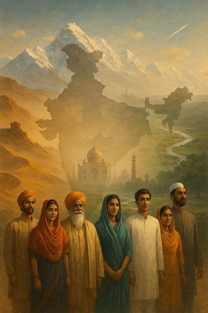
Introduction to India
India, officially known as the Republic of India, is not just a country—it is an experience shaped by history, geography, and the everyday lives of over a billion people. While studying and exploring India over the years, I realized that understanding India means understanding diversity, resilience, and continuity all at once. This article shares my learning journey about India’s geography, culture, and national identity in a way that is both informative and inspiring.
Geographical Location of India
India in South Asia
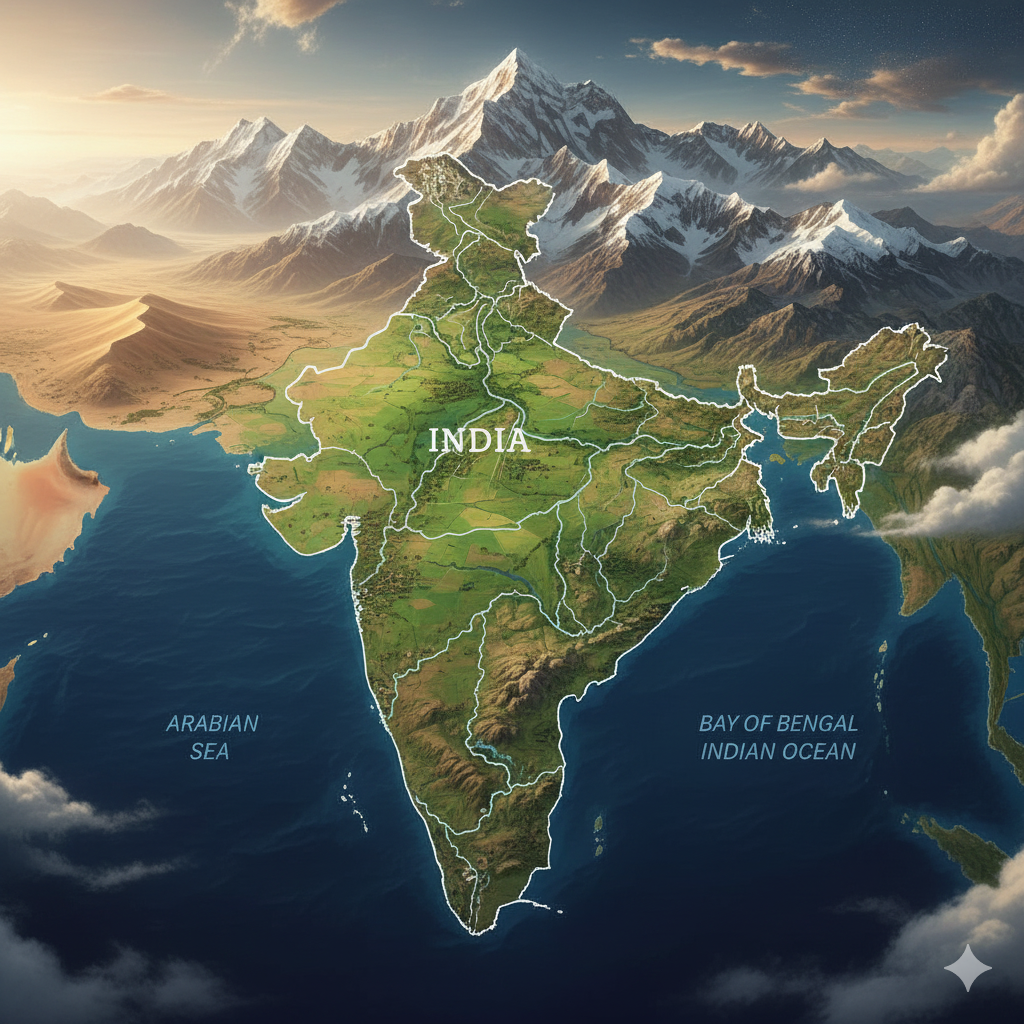
India is located in the southern part of Asia and is one of the most geographically diverse countries in the world. It is the seventh-largest country by area and the second-largest by population. This vast size plays a crucial role in shaping India’s climate, culture, and economic activities.
Natural Boundaries
The mighty Himalayan mountain range stands guard to the north, acting as a natural barrier and influencing weather patterns. To the south lies the Indian Ocean, while the Arabian Sea borders India to the west and the Bay of Bengal to the east.
Neighboring Countries
India shares its land boundaries with Pakistan, China, Nepal, Bhutan, Bangladesh, and Myanmar. These borders have shaped India’s history, trade, and cultural exchanges for centuries.
History and Culture of India
An Ancient Civilization
India’s history stretches back thousands of years. From learning about the Indus Valley Civilization to understanding the impact of Vedic culture, I found that India’s past is deeply rooted in knowledge, philosophy, and social organization.
Major Historical Phases
India has witnessed the rise and fall of powerful empires such as the Maurya and Gupta Empires, the spread of Buddhism, the grandeur of Mughal rule, and finally the era of the British Raj. Each phase added new layers to India’s cultural and political identity.
Independence and Modern India
After a long freedom struggle, India became an independent nation on 15 August 1947. This moment marked the beginning of a democratic journey that continues to evolve today.
Unity in Diversity
One of the most inspiring lessons I learned is the idea of “Unity in Diversity”. Despite differences in language, religion, customs, and traditions, India functions as a single nation bound by shared values and constitutional principles.

Featured Amazon Product
A quality and reliable product available on Amazon — click below to view full product details, the latest price, and customer reviews on the official Amazon page.
Check Price on AmazonLanguage and Religion
Linguistic Diversity
India recognizes 22 official languages. Among them, Hindi and English play a major role in administration and communication. This linguistic diversity reflects India’s cultural depth and regional identities.
Religious Harmony
Major religions practiced in India include Hinduism, Islam, Sikhism, Christianity, Buddhism, and Jainism. Over time, I have learned that India’s spiritual traditions emphasize tolerance and coexistence.
Natural Beauty and Tourism
Diverse Landscapes
India’s natural beauty is unmatched. From the serene valleys of Kashmir to the golden deserts of Rajasthan, from the peaceful backwaters of Kerala to the majestic mountain ranges of Uttarakhand, every region offers a unique experience.
Historical and Cultural Attractions
Iconic monuments such as the Taj Mahal, Qutub Minar, and Khajuraho temples attract millions of tourists and tell stories of India’s architectural and artistic excellence.
Economic and Technology Sector
A Rapidly Emerging Economy
India is one of the fastest-growing economies in the world. Agriculture, industry, and the information technology sector form the backbone of its economy.
Science and Technology
Organizations like the Indian Space Research Organisation (ISRO) have given India a strong global presence in science and technology. India’s achievements in space research are a source of national pride and inspiration.
National Symbols of India
Symbols of Identity
- National Flag: Tricolor
- National Bird: Peacock
- National Animal: Tiger
- National Flower: Lotus
- National Song: Vande Mataram
- National Anthem: Jana Gana Mana
Personal Reflection and Learning
What India Taught Me
While studying India’s geography and history, I realized that India is not defined by a single narrative. It is a living civilization that adapts while preserving its roots. This balance between tradition and modernity is what makes India truly unique.
Frequently Asked Questions (FAQ)
What is the geographical location of India?
India is located in South Asia, with the Himalayas to the north, the Indian Ocean to the south, the Arabian Sea to the west, and the Bay of Bengal to the east.
Why is India called a land of diversity?
India is called a land of diversity because it has multiple languages, religions, cultures, climates, and traditions coexisting within one nation.
When did India become independent?
India gained independence from British rule on 15 August 1947.
What are the main economic sectors of India?
The major economic sectors of India include agriculture, industry, and information technology.
Which organization represents India in space technology?
The Indian Space Research Organisation (ISRO) represents India in space research and technology at the global level.
Related Reading
To deepen your understanding, you may also explore our detailed articles on Indian History and Physical Geography of India.
Geographical Location of India
While studying Indian geography, I realized that India’s strength lies not only in its population or history, but also in its unique geographical location. India, located in South Asia, is a vast and geographically diverse country. It lies entirely in the Northern Hemisphere and extends from 8°4′ North latitude to 37°6′ North latitude and from 68°7′ East longitude to 97°25′ East longitude.
Boundaries and Size of India
Area and Global Rank
The total geographical area of India is approximately 32,87,263 square kilometers, making it the seventh-largest country in the world. Its vast size supports a wide variety of landscapes, climates, and ecosystems.
Land and Maritime Boundaries
India is bounded by the Himalayan mountain range to the north, which separates it from China, Nepal, and Bhutan. To the east lie Myanmar and Bangladesh, while Pakistan is located to the west.
India’s southern tip is surrounded by water bodies, giving the country a distinct peninsular shape:
- Arabian Sea to the west
- Bay of Bengal to the east
- Indian Ocean to the south
Sri Lanka and the Maldives lie close to India’s southern coast, further highlighting its maritime importance.

Featured Amazon Product
A quality item available on Amazon — click below to view full product details, the latest price, and customer reviews on the official Amazon listing.
Check Price on AmazonMajor Geographical Regions of India
India can be broadly divided into six major geographical regions, each with its own physical and economic significance.
Himalayan Region
Located in the northern part of India, this region contains the world’s highest mountain ranges. It is rich in glaciers and serves as the source of many important rivers.
Ganga–Brahmaputra Plains
This fertile plain is formed by rivers such as the Ganga, Yamuna, and Brahmaputra. It is one of the most productive agricultural regions of the country.
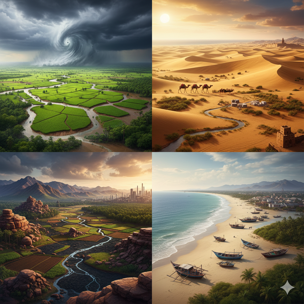
Thar Desert
Situated mainly in Rajasthan, the Thar Desert is a hot, dry, and sandy region with sparse vegetation.
Deccan Plateau
Spread across southern India, the Deccan Plateau is the oldest landmass of India and is rich in mineral resources.
Coastal Regions
The eastern and western coastal plains along the Arabian Sea and Bay of Bengal are known for beautiful beaches, fertile lands, and major commercial ports.
Western and Eastern Ghats
These mountain ranges separate the Deccan Plateau from the coastal plains and play a key role in influencing rainfall patterns.
Rivers and Water Bodies
India has an extensive river system that supports agriculture, transportation, and energy production.
Major Rivers of India
- North India: Ganga, Yamuna, Brahmaputra, Saraswati
- South India: Godavari, Krishna, Kaveri
- West India: Narmada, Tapti
The southern part of India is surrounded by seas and oceans on three sides, enhancing its strategic and economic importance.
Climate of India
Diversity of Climate
India’s climate is highly diverse due to its vast size and varied relief. Broadly, India experiences four main seasons: summer, monsoon, autumn, and winter.
Main Climate Types in India
Tropical Monsoon Climate
Found in most parts of India, especially in the south and west, this climate is characterized by high temperatures, humidity, and seasonal rainfall.
Arid and Semi-Arid Climate
This climate prevails in parts of Rajasthan, Gujarat, and Madhya Pradesh, where rainfall is low and temperatures are high.
Subtropical Climate
Common in the northern plains, summers are hot while winters can be quite cold.
Temperate (Mountain) Climate
Found in the Himalayan region, this climate is marked by low temperatures and snowfall during winter.
Coastal Climate
Present along India’s eastern and western coasts, this climate has high humidity and moderate temperature variations.
Factors Affecting the Climate of India
- Geographical location: India’s tropical position results in a generally warm climate.
- The Himalayas: Act as a barrier against cold northern winds.
- Oceans and seas: Influence humidity and rainfall in coastal regions.
- Monsoon winds: South-west and north-east monsoons are the primary sources of rainfall.
- Altitude: Higher regions experience lower temperatures.
Seasons in India
Summer (March to June)
Temperatures range from 25°C to 45°C, with extreme heat in Rajasthan and central India.
Rainy Season / Monsoon (June to September)
Monsoon rains dominate this season, with the northeastern and coastal regions receiving the highest rainfall.
Winter (December to February)
Temperatures range from 0°C to 25°C. Northern India experiences cold waves.
Autumn (October to November)
This is a transitional season with moderate temperatures after the monsoon.
Importance of India’s Climate
Agriculture
Indian agriculture depends heavily on monsoon rainfall. Kharif crops are grown in summer, while Rabi crops are grown in winter.
Biodiversity
Climatic diversity supports a wide variety of flora and fauna across the country.
Tourism
The Himalayas, deserts, beaches, forests, and plateaus attract tourists from across the world.
Cultural Diversity
Climate influences food habits, clothing, housing styles, and lifestyles in different regions of India.
Geographical Importance of India
India’s central location in Asia makes it strategically important for trade and cultural exchange. Its long coastline supports international trade and maritime activities, shaping India’s economic and historical development.
Frequently Asked Questions (FAQ)
Where is India located geographically?
India is located in South Asia, entirely in the Northern Hemisphere, between 8°4′ N to 37°6′ N latitudes and 68°7′ E to 97°25′ E longitudes.
Why is India called a peninsular country?
India is called a peninsular country because it is surrounded by water on three sides—Arabian Sea, Bay of Bengal, and Indian Ocean.
How many major geographical regions does India have?
India has six major geographical regions: the Himalayan region, Ganga–Brahmaputra plains, Thar Desert, Deccan Plateau, coastal plains, and Western & Eastern Ghats.
What role does monsoon play in India’s climate?
Monsoon winds are the primary source of rainfall in India and are crucial for agriculture and water resources.
Why is India’s geographical location important?
India’s location makes it strategically significant for trade, climate regulation, cultural exchange, and economic development.
Related Articles
You may also read our detailed guides on Physical Geography of India and Indian Climate and Monsoon System.
Geographical Importance of India
While studying India’s physical geography, one clear realization stands out—India’s geographical importance is immense and multidimensional. Its unique location, natural features, climate diversity, and ecological richness have shaped India into a major economic, cultural, and strategic center of the world. Geography has played a decisive role in India’s history, agriculture, trade, and civilization.

Featured Amazon Product
A quality item available on Amazon — click below to view full product details, the latest price, and customer reviews on the official Amazon listing.
Check Price on Amazon1. Geographical Location and Strategic Importance
India is located in South Asia and is surrounded by mighty mountain ranges and vast seas. The Himalayas act as a natural defense barrier in the north, while the Arabian Sea, Bay of Bengal, and Indian Ocean provide maritime security. This strategic location has historically made India important for security, trade routes, and international relations.
2. Geographical Importance for Climate and Agriculture
India’s geographical position directly influences its climate. The interaction of landforms with monsoon winds creates seasonal rainfall patterns. These climatic conditions are vital for agriculture, making geography the backbone of India’s food security and rural economy.
3. Geographical Importance for Trade and Commerce
India’s long coastline and peninsular shape make it a natural gateway for global trade. Since ancient times, Indian ports have connected Asia, Africa, and Europe, enhancing trade, cultural exchange, and economic development.
4. Cultural and Historical Significance
Geography has deeply influenced India’s cultural and historical evolution. Natural barriers protected civilizations, while plains and river valleys encouraged settlements. As a result, India became home to some of the world’s oldest civilizations.
5. Biological Diversity and Ecology
India’s varied relief and climate zones support extraordinary biodiversity. From tropical rainforests to alpine ecosystems, India is one of the world’s richest regions in terms of flora and fauna.
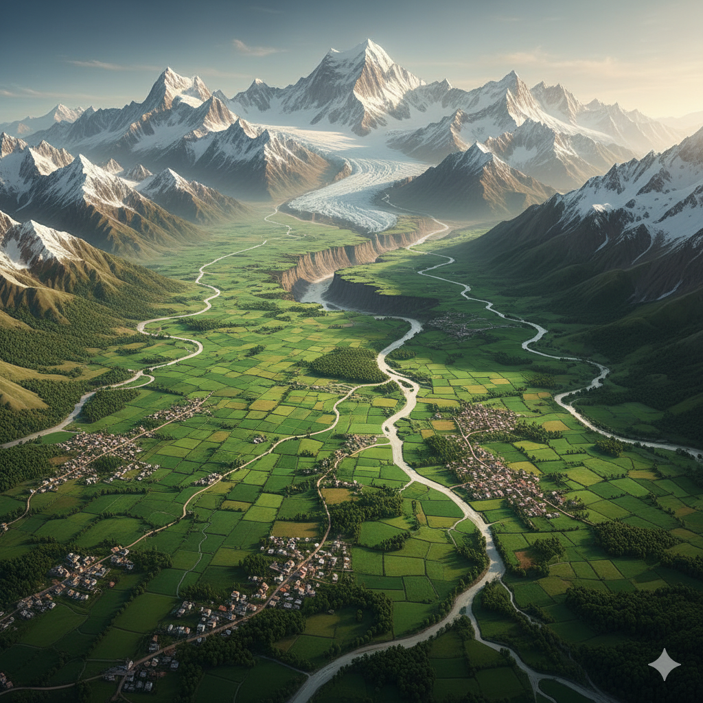
Himalayan Region
The Himalayan Region is one of the most significant physical features of India. Located in the northern part of the country, the Himalayas are not only a geographical structure but also a symbol of India’s natural strength, cultural depth, and environmental balance.
Extent and Geographical Location of the Himalayas
The Himalayan mountain range extends for about 2,400 kilometers with an average width of 400 kilometers. It stretches from Pakistan in the west to Arunachal Pradesh in the east, touching the borders of India, Nepal, Bhutan, and China.
Major Divisions of the Himalayas
1. Great Himalayas (Himadri)
This is the highest and oldest range of the Himalayas. It includes some of the world’s highest peaks such as Mount Everest (8,848 meters) and Kangchenjunga, the highest peak in India. The region remains snow-covered throughout the year and hosts major glaciers like Siachen. Important rivers such as the Ganga, Yamuna, and Brahmaputra originate here.
2. Central Himalayas (Himachal)
Situated south of the Great Himalayas, this region has altitudes ranging from 3,700 to 4,500 meters. Famous valleys such as Kashmir, Kullu, and Kangra are located here. The area is rich in forests of pine and oak and supports agriculture and tourism.
3. Shivalik Range
The Shivalik Range is the outermost and lowest range of the Himalayas, with altitudes between 900 and 1,200 meters. The fertile soils and plains, including the Terai region, make it suitable for agriculture and animal husbandry.
Natural Importance of the Himalayas
Source of Rivers
The Himalayas are the source of major rivers such as the Ganga, Yamuna, Brahmaputra, Sutlej, and Indus. These rivers act as the lifeline of India, providing water throughout the year.
Impact on Climate
The Himalayas block cold winds from Central Asia, keeping northern India relatively warm. They also obstruct monsoon winds, causing widespread rainfall across the Indian subcontinent.
Center of Biodiversity
The Himalayan region hosts diverse plant and animal species. National parks such as Jim Corbett National Park and the Nanda Devi Biosphere Reserve play a crucial role in biodiversity conservation.
Mineral and Forest Wealth
Mineral resources like limestone, copper, and zinc are found here. Forests provide timber, medicinal plants, and valuable biological resources.
Cultural and Religious Importance of the Himalayas
Religious Centers
Sacred sites such as Kedarnath, Badrinath, Amarnath, and Gangotri are located in the Himalayas, making the region a spiritual heartland of India.
Tribal Culture
Tribes such as the Gaddi, Bhutia, and Lepcha inhabit the Himalayan region and are known for their distinct cultural traditions and lifestyles.
Environmental Importance of the Himalayas
The Himalayas help control natural disasters like floods and landslides and maintain ecological balance. However, climate change, glacier melting, and deforestation pose serious challenges to this fragile ecosystem.
Ganga–Brahmaputra Plains
The Ganga–Brahmaputra Plain is the most fertile and densely populated region of India. Formed by the alluvial deposits of major rivers, it is often referred to as the “granary of the Indian subcontinent”.
Geographical Coverage
This plain extends from the Yamuna River in the west (Haryana and Delhi) to the Brahmaputra delta in the east. It is bounded by the Himalayas in the north and the Vindhya, Satpura Mountains, and Chota Nagpur Plateau in the south. The region is about 2,500 kilometers long and 300–500 kilometers wide.
Formation of the Ganga–Brahmaputra Plain
The plain is formed by alluvial deposits brought by Himalayan rivers. Tributaries such as the Yamuna, Gomti, Ghaghra, Kosi, Damodar, and Teesta enrich the soil. The average elevation is around 200 meters, making it ideal for agriculture.
Major Parts of the Plain
Western Part (Ganga Plains)
This region includes Haryana, Delhi, Uttar Pradesh, Bihar, and West Bengal. Fertility is high due to the Ganga and its tributaries.
Eastern Part (Brahmaputra Plains)
Covering Assam, Arunachal Pradesh, and Bangladesh, this region receives abundant water from the Brahmaputra and rivers like Dihing and Barak.
Delta Region
Formed by the confluence of the Ganga and Brahmaputra, this is the largest delta in the world, known as the Sundarbans Delta, famous for mangrove forests and rich biodiversity.
Characteristics of the Ganga–Brahmaputra Plains
Fertile Soil
Alluvial soil supports large-scale cultivation of wheat, rice, sugarcane, jute, and pulses.
Water Resources
Rivers provide water for irrigation, drinking, transportation, and industry.
Densely Populated Region
Favorable climate, fertile land, and water availability make this region one of the most densely populated areas of India.
Related Reading
You may also explore our articles on Physical Geography of India and Indian Climate and Monsoon System.

Western and Eastern Ghats
The Western and Eastern Ghats are among the most important mountain ranges of India, located in the southern and central parts of the country. These ranges separate the Deccan Plateau from the coastal plains and play a vital role in shaping India’s geographical, environmental, and cultural landscape.

Featured Amazon Product
A quality and reliable item available on Amazon — click below to view full product details, the latest price, and customer reviews on the official Amazon page.
Check Price on AmazonWestern Ghats
Geographical Location
The Western Ghats run almost parallel to the west coast of India for about 1,600 kilometres. This mountain range passes through the states of Gujarat, Maharashtra, Goa, Karnataka, Kerala, and Tamil Nadu.
Major Features
- Average Height: 900–1,600 metres
- Highest Peak: Anaimudi Peak (2,695 m)
- Other Important Regions: Mahabaleshwar, Nilgiri Hills
- Rivers Originating: Godavari, Krishna, Cauvery, Tapti
Biodiversity
The Western Ghats are recognized as a UNESCO World Heritage Site. This region is known for its evergreen forests and rich biodiversity, including many endemic species of plants and animals. Protected areas such as Periyar Wildlife Sanctuary and Silent Valley National Park are globally significant for environmental conservation.
Importance of the Western Ghats
- Plays a crucial role in influencing the Indian monsoon
- Major center for tea, coffee, and spice cultivation
- Supports several hydroelectric power projects
Eastern Ghats
Geographical Location
The Eastern Ghats extend parallel to the Bay of Bengal and pass through Odisha, Andhra Pradesh, Tamil Nadu, and parts of Chhattisgarh. Unlike the Western Ghats, this range is highly fragmented and discontinuous.
Major Features
- Average Height: 600–900 metres
- Highest Peak: Mahendragiri (1,501 m) in Odisha
- Important Regions: Araku Valley (Andhra Pradesh)
- Major Rivers: Mahanadi, Godavari, Krishna, Kaveri (flow into the Bay of Bengal)
Biodiversity
The Eastern Ghats mainly support drought-resistant and deciduous vegetation. Wildlife sanctuaries such as the Simbhalika Tiger Reserve contribute to the conservation of flora and fauna in this region.
Importance of the Eastern Ghats
- Rich in mineral resources such as bauxite, coal, and manganese
- Supports agriculture, especially paddy cultivation
- Plays a role in regulating river flow into the Bay of Bengal
Similarities and Differences between Western and Eastern Ghats
| Western Ghats | Eastern Ghats |
|---|---|
| Located parallel to the west coast | Located parallel to the east coast |
| Higher elevation and continuous range | Lower elevation and fragmented range |
| Receives heavy monsoon rainfall | Receives comparatively less rainfall |
| Evergreen and dense forests | Dry and deciduous vegetation |
| Extremely rich biodiversity | Relatively lower biodiversity |
Overall Importance of the Ghats
Geographical Importance
The Western and Eastern Ghats act as natural barriers separating the Deccan Plateau from the coastal plains. They influence river systems, rainfall patterns, and regional climates across India.
Economic Contributions
These regions contribute significantly to India’s economy. The Western Ghats are known for spices, tea, and coffee, while the Eastern Ghats support mining industries and agriculture.
Environmental Significance
Both mountain ranges function as natural water catchment areas. The Western Ghats are critical for biodiversity conservation, while the Eastern Ghats are important for mineral wealth and regional ecology.
Conclusion
India’s geography is a remarkable blend of mountains, plains, plateaus, deserts, rivers, and coasts. Each geographical region—from the Himalayas and Ganga–Brahmaputra Plains to the Thar Desert, Deccan Plateau, coastal areas, and the Western and Eastern Ghats—contributes uniquely to the nation’s identity.
India’s rivers and climate sustain agriculture, culture, and spiritual life, while its seas—the Arabian Sea, Bay of Bengal, and Indian Ocean—support trade, biodiversity, and strategic interests. The conservation and sustainable use of these natural resources are essential for India’s long-term stability and development.
The Western and Eastern Ghats stand as pillars of India’s environmental balance. Their protection and sustainable management are vital to ensure ecological stability, economic prosperity, and a resilient future for the country.