The Valleys and Passes of the Himalayas: Geography, Travel Tips and Insights

Introduction: Why the Valleys and Passes of the Himalayas Are Truly Unique

Whenever I think of the Himalayas, I do not just imagine towering snow-covered peaks or vast stretches of silence. I imagine the winding paths, the deep valleys, and the ancient passes that have guided travelers, monks, merchants, and explorers for thousands of years. The Himalayas are not merely a mountain range—they are a living encyclopedia of nature, culture, and human courage. Every valley is a chapter, every pass is a gateway, and every journey through them becomes a story of self-discovery.

This article aims to take you on a meaningful journey through the iconic valleys and passes of the Himalayas. Through a blend of geographical insights, historical perspectives, and my own experiences, I hope to show how these landscapes are not only breathtaking to look at, but also powerful teachers. Whether you are a student, a traveler, a trekking enthusiast, or simply someone curious about the world, you will find that the Himalayas offer a deep understanding of nature, resilience, and human connection.

Himalayan valleys are more than just scenic wonders; they are home to ancient cultures, vibrant communities, and ecosystems that have existed for centuries. Meanwhile, the passes—whether it is Rohtang, Khardung La, Nathu La, Baralacha La, or countless others—have played a crucial role in shaping trade, diplomacy, cultural exchange, and historical events across Central and South Asia. These passes have connected nations, carried ideas, and sparked encounters that changed the course of civilizations.

In the sections that follow, you will learn how valleys are formed, why passes were strategically important, which regions are most significant, and what makes each area unique. You will also read about environmental challenges such as glacial melt and land degradation—threats that the Himalayas face today. Alongside this, I will share personal moments from my journeys: the first time I saw snowfall at high altitude, the calm that settles in during long treks, and the unexpected kindness of people living in remote Himalayan villages.

This introduction is only the beginning. The real essence of the Himalayas lives not in the peaks alone, but in the valleys that cradle life and the passes that test your endurance. Come with me on this exploration— descending into the heart of the valleys and rising to the heights of the legendary passes.

Geography and Formation: Understanding Himalayan Valleys and Passes

The Himalayas are not just a chain of towering peaks; they are a living, shifting landscape shaped by immense geological forces and a tapestry of climate zones. To truly appreciate the valleys and passes of the Himalayas, we must look beyond the dramatic summits and examine how water, ice, rock, and time carve routes that sustain life, connect cultures, and challenge travelers. This section explains the essential differences between valleys and passes, the main landscape types you will encounter, and the geological processes that keep the range dynamic.

Valleys vs Passes — the key differences

In simple terms, a valley is a low-lying area between mountains, often hosting rivers, villages and vegetation; it cradles ecosystems and human settlements. A pass (or “mountain pass”) is a higher, relatively level corridor through a ridge or between peaks that permits movement from one valley or region to another. Valleys are centers of life and continuity; passes are points of connection, trade, and sometimes strategic importance. Both are essential to the Himalayan story, but they play very different roles in ecology, culture, and travel.

Major landscape types

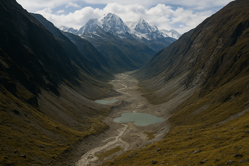
Glacial valleys (U-shaped valleys)

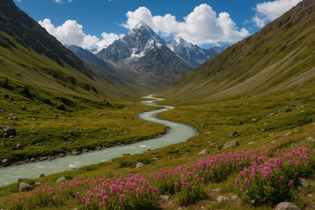
Many Himalayan valleys were carved by the slow but relentless movement of glaciers. These glacial valleys are typically broad and U-shaped, with steep sides and a flat floor where moraines and glacial lakes often form. Examples include the valleys around major glaciers such as Gangotri and Milam. High up, the vegetation thins to alpine grasses and hardy shrubs, while glacial meltwater feeds rivers below.

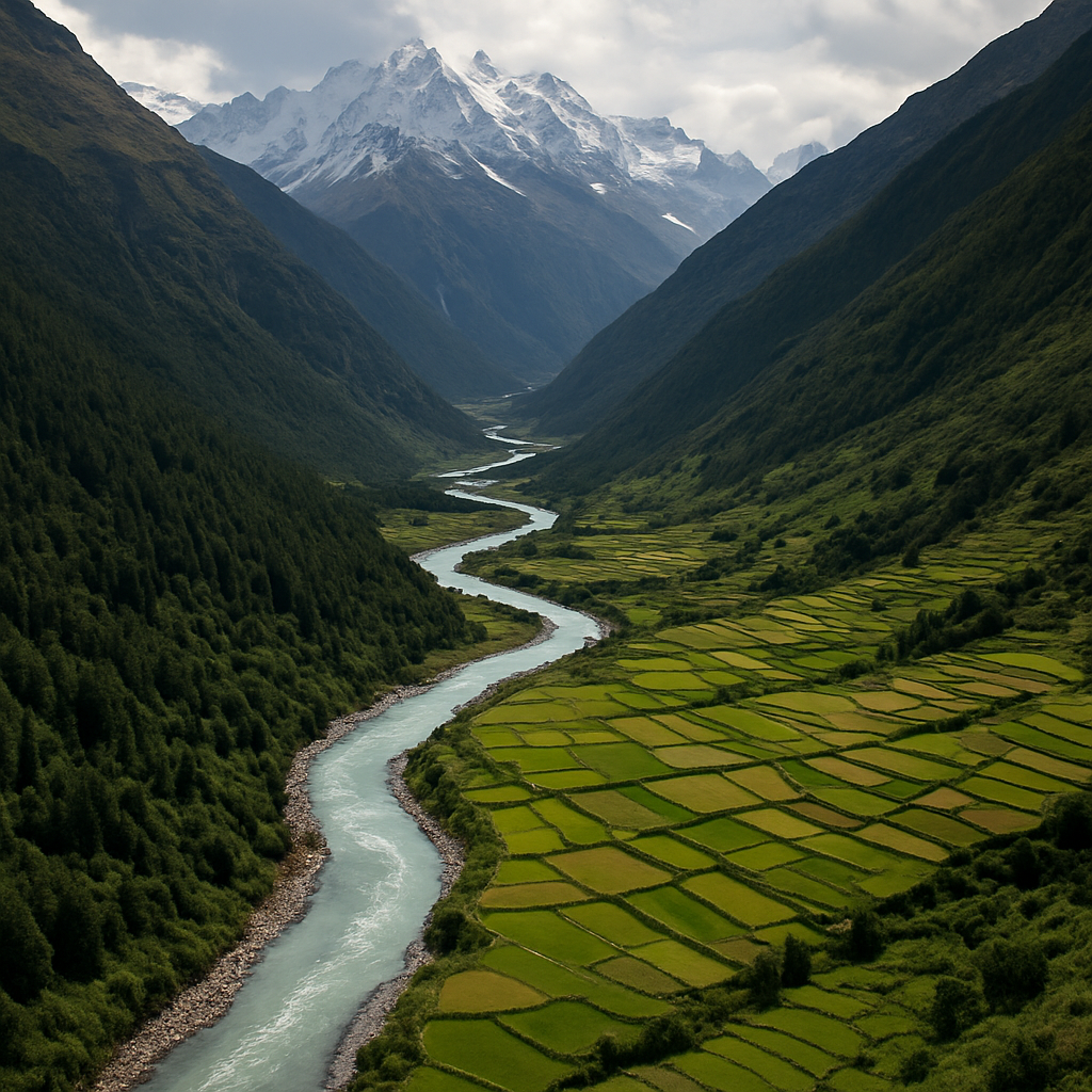
River-cut valleys (V-shaped valleys)

Where rivers are the dominant sculptors, valleys often take on a V-shaped profile, with narrow gorges and actively incising streams. These river valleys are dynamic corridors for sediment transport and support more extensive human habitation and agriculture—think of river-fed valleys where terraced fields and mountain towns cluster along the watercourse.

High-altitude passes

Mountain passes sit at higher elevations—often between 3,000 and 5,500 meters in the Himalayas—and act as natural gateways between drainage basins. Passes like Rohtang, Baralacha La, Khardung La and Nathu La have historically connected trade routes and cultural zones. Conditions at passes are harsh: sudden weather changes, thin air, and seasonal closures are common.

Altitude, climate and biodiversity

Altitude controls climate and therefore vegetation and wildlife. As you ascend from foothills to alpine zones, temperature drops and species composition changes rapidly. Lower Himalayan belts host dense subtropical and temperate forests, mid-elevations support coniferous woodlands, and high alpine meadows and scree dominate above the tree line. This vertical zonation creates remarkable biodiversity: snow leopards, Himalayan musk deer, red pandas and many endemic plants are distributed according to elevation and microclimate. Climate change and glacial retreat are reshaping these zones, altering water supply and habitat ranges for both humans and wildlife.

Geological processes that formed the range

Plate tectonics and uplift

The Himalayas are the result of the ongoing collision between the Indian and Eurasian tectonic plates. This collision folded and uplifted vast layers of rock and continues to raise the range slowly today. The same tectonic activity makes the region seismically active, shaping long-term landscape evolution.

Erosion and weathering

Once uplifted, the mountains are continually reshaped by erosion: rivers, rainfall, freeze–thaw cycles and mass wasting wear down ridges and deepen valleys. Erosion redistributes rock and soil, creating fertile valley floors but also steep slopes susceptible to landslides.

Glacial processes

Glaciers act as both sculptors and archives. Their movement carves valleys and deposits moraines and outwash plains. Melting glaciers feed perennial rivers that sustain downstream communities, but accelerated melting due to warming climates poses risks of glacial lake outburst floods (GLOFs) and long-term water stress.

Understanding these forms and forces helps anyone who studies, visits, or lives in the Himalayas to read the landscape like a living map—one that records ancient collisions, seasonal cycles, and the fragile balance between ice, water, rock, and life.

Himalayan Monastery — Flow of Religion, Culture

Historical and Cultural Significance

The valleys and passes of the Himalayas are far more than dramatic landscapes — they are living archives of human history. For millennia these routes have channeled trade, pilgrimage, cultural exchange, and military movement across South and Central Asia. Each pass and valley carries stories of caravans, sages, traders and armies, and each has shaped the identities of the communities that dwell in their shelter.

Passes — ancient trade routes and pan-Asian connections

Mountain passes in the Himalayas served as vital arteries of commerce and communication long before modern roads existed. Through passes such as Nathu La, Shipki La, Karakoram and historically significant corridors across Ladakh and eastern Nepal, merchants transported salt, wool, spices, silk, religious texts and artisan goods between the Tibetan plateau, Central Asia and the Indian subcontinent. These corridors were often seasonal and dangerous — caravans timed their journeys to avoid winter snows — yet they persisted because the economic and cultural rewards were immense.

Beyond material trade, passes enabled the flow of ideas, religions and art. Buddhism, for example, spread along these mountain routes from India into Tibet and Central Asia; similarly, architectural styles, metalworking techniques and textile motifs migrated across passes and were assimilated into local traditions. Strategically, passes also mattered in warfare and diplomacy: control of a key pass could determine movement of troops, access to resources, or the security of a frontier.

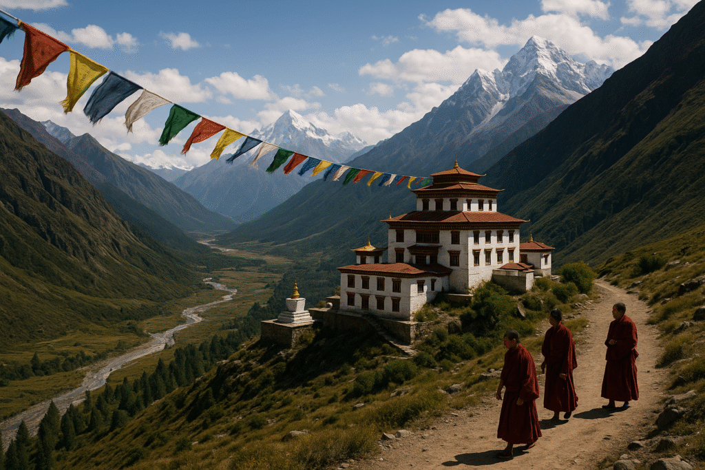
Valleys — the cradle of communities and culture

Valleys are the social and economic heartlands of the Himalayan world. Fed by glacial and riverine waters, valleys provide arable land, microclimates suitable for agriculture, and natural sites for villages and towns. Over generations, distinct cultural practices, dialects and livelihoods evolved in valley settings: terrace farming, pastoral circuits, craft specializations, and ritual calendars tuned to local seasons.

The cultural expressions that emerged in Himalayan valleys are diverse—folk songs and dances tied to sowing and harvest, unique textile traditions, shrine-centered festivals, and oral histories that record migrations, local heroes and sacred landscapes. Many valleys are associated with specific religious traditions; monasteries, temples and pilgrimage trails anchor spiritual life and act as focal points for social gatherings and trade fairs.

Pilgrimage, myth and oral history

Pilgrimage routes often follow valley floors and cross passes, binding communities through shared rituals and seasonal flows of people. Sacred sites located in valleys or at high passes—shrines, caves, and mountain-top temples—generate myths that explain the landscape and its moral order. These narratives preserve ecological knowledge (for instance, sacred groves and taboo zones) and regulate resource use through customary rules passed down across generations.

Modern change and cultural resilience

Modern roads, tourism, media and education are transforming valley societies and pass communities. Infrastructure brings opportunities—market access, healthcare and schooling—but can also disrupt traditional lifeways, accelerate language loss, and change social roles. Tourism introduces new incomes and pressures: souvenir markets can revive handicrafts, yet over-tourism can strain water, waste and cultural integrity.

Cultural preservation and responsible development are therefore urgent. Community-led tourism, protection of sacred sites, support for local crafts, and policies that respect land and water rights can help maintain the deep cultural fabric of Himalayan valleys while allowing communities to benefit from change. Ultimately, understanding the historical roles of valleys and passes helps us appreciate why their cultural heritage matters — not only as relics of the past, but as living systems that sustain identity, knowledge and resilience for future generations.

Rohtang Pass — Gateway to the High Himalayas

Famous Valleys and Passes — Case Studies

The Himalayan region is home to countless valleys and passes, each shaped by unique geological forces and enriched by deep cultural histories. Some of these routes have become legendary for their beauty, their strategic importance, or their role in sustaining communities across harsh terrains. The following case studies highlight three such iconic locations, offering insight into their landscapes, history and modern significance.

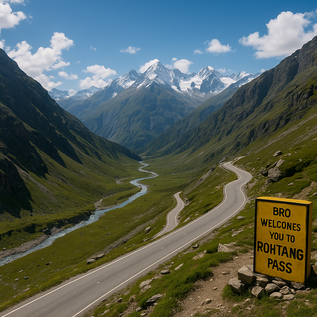
Case Study 1: Rohtang Pass — A Gateway on the Manali–Leh Route

Rohtang Pass, situated at an altitude of about 3,979 meters, serves as one of the most vital links between Manali and the remote regions of Lahaul–Spiti and Ladakh. Historically, this pass functioned as a seasonal trade route, enabling caravans, pastoral communities and local traders to navigate across the formidable Pir Panjal range. Its name, derived from Sanskrit roots meaning “field of corpses,” reflects the extreme weather challenges that once made this crossing perilous for travelers.

As one ascends toward Rohtang, the landscape transforms dramatically—from dense pine forests and alpine meadows to snow-covered slopes and rocky stretches. Panoramic views of the Beas River valley and the Himalayan horizon draw countless visitors each year. Beyond tourism, the pass remains strategically crucial for the Indian Army and for remote communities dependent on supplies during short summer windows.

Though the Atal Tunnel has eased winter hardships and reduced dependence on the pass, Rohtang continues to symbolize the Himalayan environment’s unpredictability and the resilience of mountain cultures. Its terrain, climate and legacy offer a vivid glimpse into how high-altitude passes have shaped mobility and survival in the region.

Case Study 2: Kheerganga Valley — A Blend of Nature, Spirituality and Adventure

Kheerganga Valley, nestled in Himachal Pradesh’s Parvati region, is renowned for its mystical atmosphere, hot springs and scenic trails. Located at around 3,000 meters, it attracts trekkers from across the world seeking both natural beauty and spiritual calm. Local legends speak of Lord Kartikeya meditating here, while the valley’s name comes from the milky-white appearance of nearby thermal water streams.

The trek to Kheerganga spans lush forests, cascading waterfalls, wooden bridges and narrow ridges. Historically, this path served as a movement corridor for shepherds and local villagers accessing high-altitude pastures and summer settlements. The changing landscape—from dark conifer woods to bright, open meadows—offers a sensory journey that many travelers describe as transformative.

Kheerganga is also a living example of how tourism and fragile ecosystems intersect. While the valley supports the livelihood of local communities through homestays and small eateries, rising footfall has brought environmental concerns such as waste and trail erosion. Today, conservation efforts and responsible tourism practices aim to protect the valley’s delicate balance, ensuring its natural and cultural heritage remains intact.

Case Study 3: Nainital Valley — Cultural Heritage and Serene Mountain Beauty

Nainital Valley, located in the Kumaon region of Uttarakhand, is famous for its crescent-shaped lake, cool climate and thriving hill-town culture. Situated at about 2,084 meters, Nainital has long served as a center of administration, education and tourism. The British-era legacy of the town—combined with traditional Kumaoni heritage—gives the valley a distinctive character.

Nainital’s geographical structure enhances its charm. The valley is encircled by forested mountains, forming a natural amphitheater around Naini Lake. The lake not only supports local tourism and recreation but also provides water and livelihoods for nearby communities. The mild climate and scenic surroundings have drawn scholars, artists and travelers for generations.

The cultural richness of the valley is reflected in Kumaoni festivals, folk dances such as the Chholiya, traditional wooden crafts and local cuisine. Markets display intricately carved artifacts, woolen garments and herbal products unique to the region. However, like many Himalayan valleys, Nainital faces ecological pressures due to unplanned urbanization and high tourist inflow. Local authorities and community groups are now promoting sustainable tourism practices to protect its fragile environment.

Nainital stands today as a model of how natural landscape, cultural identity and modern aspirations interact within a single valley—making it one of the most recognizable Himalayan destinations.

Himalayan Ecology — Glacial Rivers, Alpine Meadows & Fragile Biodiversity”

Ecology and Conservation

The Himalayan valleys and passes are ecological hotspots and fragile landscapes where biodiversity, water resources, and human livelihoods intersect. Their vertical climate zones—from subtropical foothills to alpine meadows and cold deserts—support unique species and ecosystems. At the same time, accelerated glacial melt, soil erosion, expanding infrastructure and rising tourism are placing increasing stress on these systems. This section outlines the key ecological values, major threats, and practical conservation responses driven by communities and scientists.

Biodiversity — a mountain of life

The Himalayas host extraordinary biodiversity organized along elevation gradients. Lower belts hold broadleaf and mixed forests; mid-elevations are dominated by conifers; alpine meadows and rhododendron-rich zones appear above the treeline; and cold desert zones occur at the highest elevations. Iconic and often endemic animals — snow leopard, Himalayan musk deer, red panda, Himalayan monal and numerous medicinal plants — rely on these habitat mosaics. This vertical layering creates many microhabitats and high species richness, making the region globally significant for conservation.

Key threats

Accelerating glacial melt and water risks

Warming temperatures are accelerating glacial retreat. In the short term this can increase river flows and glacial-lake outburst flood (GLOF) risk; in the long term it threatens reliable dry-season water supply for downstream communities, agriculture and hydropower. Changes in melt timing also affect sediment transport and river morphology.

Soil erosion, landslides and landscape instability

Intense rainfall events, deforestation, unplanned road building and unsustainable land use amplify erosion and landslide frequency. Soil loss reduces agricultural productivity, damages infrastructure and undermines slope stability—compounding ecological and human vulnerability.

Tourism and local ecological pressure

Tourism generates income but also increases waste, water demand, trail erosion and pressure on local resources. Without strict waste management and visitor limits, fragile alpine and riparian zones can degrade rapidly.

Local and community-led conservation efforts

Many of the most effective conservation actions in the Himalaya are community-based. Traditional practices—sacred groves, pasture rotation, customary forest rules—often conserve biodiversity while supporting livelihoods. Contemporary initiatives combine local stewardship with science: community forests, village conservation committees, participatory watershed management, early warning systems for floods, and community-managed tourism that channels benefits to local households.

Practical measures and policy directions

  • Community forestry & tenure security: strengthening local rights encourages long-term stewardship.
  • GLOF monitoring & early warning: mapping lakes, installing gauges, and training communities.
  • Sustainable tourism: visitor caps, waste protocols, eco-certified homestays and trail rehabilitation.
  • Soil & water conservation: check dams, contour planting, reforestation and pasture management.
  • Scientific monitoring: glacier mass balance studies, biodiversity surveys and climate-informed planning.

What individuals can do

Travelers can minimize impact by following “leave no trace” principles, using local guides, avoiding single-use plastics, and supporting community businesses. Policymakers and NGOs should prioritize integrated, locally led strategies that balance livelihoods, cultural values and ecological resilience.

Conserving Himalayan ecology is both a local and global responsibility. Protecting these mountain systems preserves biodiversity, secures water for millions downstream, sustains cultural heritage, and builds resilience to a changing climate.

Solo Himalayan Trek — Safety, Awareness & Inner Journey”

Safety, Guidance and Travel Tips

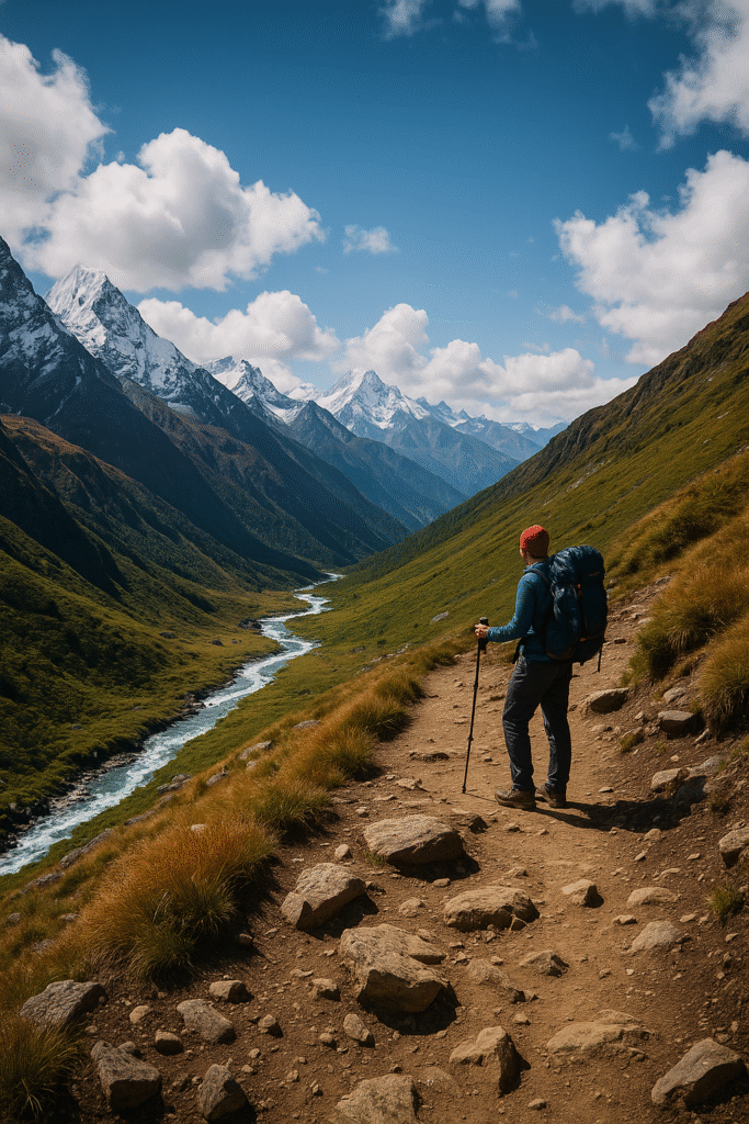
Traveling in the Himalayas is an immensely rewarding experience, but it requires careful preparation and respect for mountain conditions. Altitude, weather variability, permits, local rules and health risks all influence how safe and enjoyable a trip will be. Below is a practical, easy-to-follow guide that covers best seasons, necessary permits, the role of local guides, altitude-sickness awareness, and a compact packing list.

Best time to visit (seasonal windows)

The most reliable periods for Himalayan travel are spring (April–June) and autumn (September–November). During these windows, the weather is generally stable, passes are more likely to be open, and visibility is excellent. The monsoon (July–August) brings heavy rains, slippery trails and heightened landslide risk, while deep winter (December–February) often closes high passes due to heavy snow and extreme cold—only for very experienced, well-equipped travelers and guided expeditions.

Permits and local regulations

Numerous high-altitude regions require official permits—these can include protected-area permits, Inner Line Permits (ILP), restricted-area permits, or park entry fees. Permit rules vary by state and valley. Always check the latest requirements with local tourism offices or official government portals before you travel. Carry physical copies of permits and ID while on the route.

The importance of local guides

Hiring a knowledgeable local guide or porter is one of the best safety investments you can make. Local guides know microclimates, seasonal trail conditions, safe camping spots and cultural etiquette. They also assist with navigation, emergency response and communicating with communities—plus your payment supports the local economy.

Recognizing high-altitude symptoms (Altitude awareness)

Acute Mountain Sickness (AMS) can affect anyone above ~2,500–3,000 meters. Common early symptoms include:

  • Headache and dizziness
  • Nausea, loss of appetite
  • Fatigue and trouble sleeping
  • Shortness of breath during light activity

If symptoms worsen (confusion, severe breathlessness, coughing up frothy sputum, inability to walk), descend immediately and seek medical help—these may indicate High Altitude Pulmonary Edema (HAPE) or High Altitude Cerebral Edema (HACE), both life-threatening. Always acclimatize slowly: ascend gradually, include rest days, stay hydrated, and avoid alcohol. Consult a physician before travel—medications such as acetazolamide may be recommended for prevention in some travelers.

Packing checklist — essentials for Himalayan travel

  • Layered clothing: base layers, insulating mid-layers, waterproof outer shell
  • Warm hat, gloves, thermal socks and sturdy trekking boots
  • Daypack, waterproof cover and dry sacks
  • Sun protection: sunglasses, high-SPF sunscreen, lip balm
  • Reusable water bottle, water purification tablets or filter
  • Headlamp/torch, spare batteries and a power bank
  • Comprehensive first-aid kit, blister care, personal medications
  • Copies of permits, ID, emergency contacts and local SIM or satellite communication if needed

Photography and drone rules

Photography is widely permitted, but respect privacy and cultural norms—always ask before photographing people or religious ceremonies. Many border and military zones strictly prohibit photography. Drone use is regulated: you may require special permits and certain high-altitude or sensitive locations ban drones entirely. Check national drone regulations and local restrictions, register your device if required, and avoid flying near crowds or wildlife.

Weather-based tips

  • Spring (Apr–Jun): Expect rapidly warming days and cold nights—carry layers and sun protection.
  • Monsoon (Jul–Aug): Avoid unstable slopes; prefer lower-altitude activities and check landslide advisories.
  • Autumn (Sep–Nov): Clear skies and stable weather—ideal for photography, but pack warm night gear.
  • Winter (Dec–Feb): Prepare for snow, short daylight and possible route closures—do not attempt high passes alone.

With sensible planning, respect for local rules and a cautious approach to altitude and weather, Himalayan travel can be safe, transformative and deeply rewarding. Prioritize preparation, local knowledge and flexible plans over rigid itineraries.

Personal Journey and Lessons: A Himalayan Tale

Some journeys change the way you see the world; my trek through the Himalayan valleys and passes was one of those rare journeys. It was not a single dramatic event but a sequence of small tests—of weather, endurance, patience and trust— that gradually reshaped my sense of risk and reward. The mountains taught me about silence, scale and humility. Below I share the key moments and lessons from that trip: how I prepared, the turning point when fear met resolve, and the quiet transformation I felt after returning home.

Preparation — aligning mind, body and kit

Preparation began months before the first step. Physically, I built stamina with regular hikes and stair workouts; mentally, I rehearsed scenarios—bad weather, slow progress, illness—and practiced staying calm. I researched the route, spoke with local guides, and read firsthand accounts to understand the rhythm of the valleys. Packing was intentional: not more, but smarter—layered clothing, a well-stocked first-aid kit, a small journal, and a few comfort items that mattered to me.

Equally important was letting go of urban certainties. I reduced my reliance on rigid plans and learned to value contingency: extra days for acclimatization, flexible travel windows, and an openness to change the route when nature demanded it. I also made a small vow—to listen twice as often as I speak. That promise meant listening to the mountain’s moods, to the counsel of my guide, and to the quiet instincts of my own body.

The turning point — fear, endurance and a new perspective

The turning point came halfway through, on a narrow ridge above a glacial stream. The sky that morning was ambiguous—sun one moment, heavy clouds the next. The path narrowed, loose scree shifted underfoot, and my breath felt shallow despite the slow pace. Small anxieties multiplied: the route felt longer than the map, the wind felt colder than the thermometer, and a rumor of an incoming storm circulated among other trekkers.

In that fragile stretch, fear operated like a lens—focusing my attention tightly on immediate risks. My instinct was to hurry, to conquer the distance and escape the unease. Instead, the guide suggested a different map: stop, sit, breathe, and assess. We inspected boots, tightened straps, checked the weather on a basic device and observed the mountain for fifteen minutes. That pause changed everything. The wind’s pattern made sense, a safe line of stones appeared, and my heart rate slowed. The lesson was simple but deep: in high places, speed can create danger, and patience becomes a survival skill.

Beyond technique, that moment highlighted a rarer lesson—humility. The mountain did not yield to force. It rewarded respect, small adjustments, and the ability to change plans without losing purpose. I continued, but my stride was now steadier, my focus kinder. Fear was not eliminated; it was reshaped into a teacher that insisted on presence rather than panic.

Feelings upon return — calm, reorder and the quiet work of integration

Returning home felt less like the end of an expedition and more like stepping into a new chapter. The first weeks after the trip were surprisingly gentle: I slept deeper, my appetite for trivial complaints shrank, and ordinary city sounds—traffic, ads, hurried voices—seemed louder and oddly distant. The mountains had rearranged priorities. Small comforts mattered more, and the constant hunger for novelty softened into gratitude for stability and relationships.

The deeper change was internal. I found myself approaching problems with a quieter confidence—less need to force solutions, more willingness to gather information and wait. The notebook I carried from the journey became a reference for decisions: reminders of patient choices, of people’s kindness in remote places, and of how small rituals (a hot drink, a steady breath) could steady the mind in chaos.

Ultimately, the Himalayas offered a simple curriculum: respect the landscape, prepare carefully, and treat fear as an honest messenger. That education stays with me—less as dramatic advice and more as a set of habits that make life clearer, kinder, and more attuned to what truly matters.

Conclusion and Inspirational Message

The valleys and passes of the Himalayas are far more than spectacular landforms—they are living classrooms of resilience, culture, and humility. Walking through these landscapes teaches us about the delicate balance between nature’s strength and its fragility. Valleys nurture life, communities and traditions, while passes connect entire regions through trade, stories, and shared histories. Together, they embody the essence of the Himalayan spirit: endurance, interconnectedness, and quiet wisdom shaped over centuries.

In today’s world, where climate change, glacial retreat and land degradation pose increasing challenges, responsible travel has never been more important. Protecting these ecosystems is not just a scientific concern but a moral one—because every action we take, from minimizing waste to supporting local livelihoods, directly impacts the future of these fragile regions. Sustainable practices, environmental awareness and respect for local knowledge can help preserve the natural and cultural treasures that make the Himalayas so extraordinary.

On a personal level, the Himalayas taught me that courage is not merely about pushing harder, but about listening—to the body, to the weather, to the land. Overcoming fear does not mean eliminating it; it means learning from it. The clarity, peace and broader perspective I gained after returning from the mountains still shape my choices. The Himalayas remind us that growth often comes from slow, patient steps rather than leaps.

As you plan your own journey, I encourage you to travel with intention: respect the silence, embrace the challenges, support local communities and carry back not just photographs, but lessons. With the guidance, safety tips and conservation insights shared in this article, your Himalayan experience can be memorable, meaningful and responsible.

Frequently Asked Questions (FAQ)

1. What is the best time to visit the Himalayas?

The ideal time to travel in the Himalayas is during spring (April–June) and autumn (September–November). These seasons offer stable weather, clear views and open passes. Monsoon months can bring landslides and slippery trails, while deep winter often closes high routes due to snow and extreme cold.

2. Do I need permits to enter certain valleys or passes?

Yes, several regions require permits such as Protected Area Permits, Inner Line Permits (ILP) or park entry passes. Requirements vary by state and trail. Always check updated regulations through official government portals or local authorities before your trip.

3. Is altitude sickness (AMS) common, and how can I prevent it?

Altitude sickness is common above 2,500 meters. Symptoms include headache, nausea, fatigue and shortness of breath. Prevent it by ascending slowly, drinking enough water, avoiding alcohol, and taking rest days. If symptoms worsen, descend immediately and seek medical support.

4. Is it safe to travel alone in the Himalayas?

Solo travel is possible for experienced trekkers who understand routes, weather and emergency protocols. Beginners should hire a local guide for safety and cultural context. Group travel enhances safety and helps during unexpected conditions.

5. Are photography and drone use allowed?

Photography is generally allowed, but border and military-sensitive areas may restrict camera use. Drone use often requires special permits and is banned in certain high-altitude or protected zones. Always check local regulations before flying a drone.

6. Can children and older adults travel in the Himalayas?

Yes, but choose lower-altitude and beginner-friendly routes. High passes and strenuous treks are not advisable for children or elderly travelers. Proper health checks, slow pace and adequate rest are essential for family travel.

7. What essential items should I pack?

Pack layered clothing, trekking boots, a first-aid kit, reusable water bottle, headlamp, sunglasses, sunscreen, dry sacs and personal medications. Weather changes quickly, so waterproof bags and spare socks are important.

8. Is it safe to eat local food and drink local water?

Local food is typically safe when sourced from clean and reputable places. Drink filtered, purified or bottled water. Natural streams may look clean but can contain microorganisms, so always purify before drinking.

Leave a Comment

Your email address will not be published. Required fields are marked *

Scroll to Top