
India
- Location and boundaries
- Natural features
- Major geographical regions of India:
- Himalayan Region
- Northern Plains
- desert area
- Deccan Plateau
- Coastal areas and islands
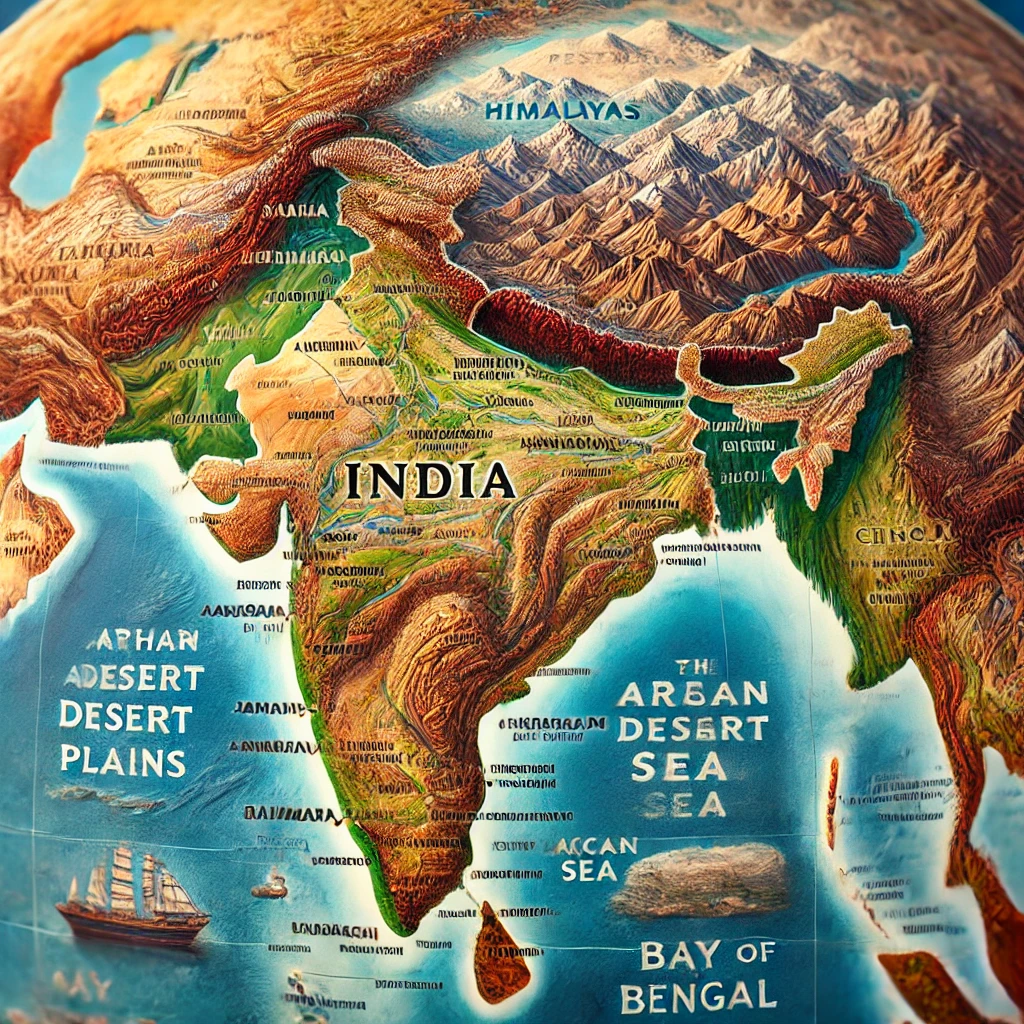
India’s geographical structure is extremely diverse and rich , which makes it unique in terms of natural beauty and resources. Various types of mountains , plains , plateaus , deserts , coastal areas and archipelagos are found here.
1. Location and boundaries
India is located in South Asia , which has a triangular shape. It is surrounded by the Himalayan mountain range in the north and extends to the Indian Ocean in the south. Boundaries of India:
- In reply: China , Nepal , and Bhutan
- Formerly: Bangladesh and Myanmar
- In the West: Pakistan and Afghanistan
- In the south: Indian Ocean , Lakshadweep and Sri Lanka
2. Natural features
The natural features of India divide it into four major climatic zones:
- Tropical monsoon climate ( South India)
- Temperate Climate ( Himalayan Region)
- Desert climate ( Thar Desert of Rajasthan)
- Oceanic climate ( in western and eastern coastal areas)
3. Major geographical regions of India
(a) Himalayan region
The Himalayan mountain range stretches across the northern part of India. It is the highest mountain range in the world , containing peaks like Mount Everest and Kanchenjunga. It not only serves as a natural boundary but is also the source of major rivers of India such as Ganga , Yamuna , Brahmaputra.
(b) Northern Plains
This region is made up of alluvial soil of the Ganga , Yamuna and Brahmaputra rivers. The soil here is extremely fertile , making it an ideal area for agriculture. States like Punjab , Haryana , Uttar Pradesh fall in this region.
(c) Desert region
The Thar Desert of Rajasthan is the main desert region of India. It has sand dunes , dry climate , and low rainfall. However , farming has been made possible here due to irrigation measures like Indira Gandhi Canal Project.
(d) Deccan Plateau
The Deccan Plateau is located in the central and southern parts of India. It is made up of hard rocks and black soil is found here , which is suitable for cotton cultivation. The Satpura , Vindhyachal , and Western Ghats hills are prominent here.
(e) Coastal areas and islands
The eastern and western coastal plains of India are important for maritime trade and fisheries. The Arabian Sea lies on the western coast and the Bay of Bengal on the eastern coast. The Andaman-Nicobar and Lakshadweep Islands are famous for marine biodiversity and tourism.
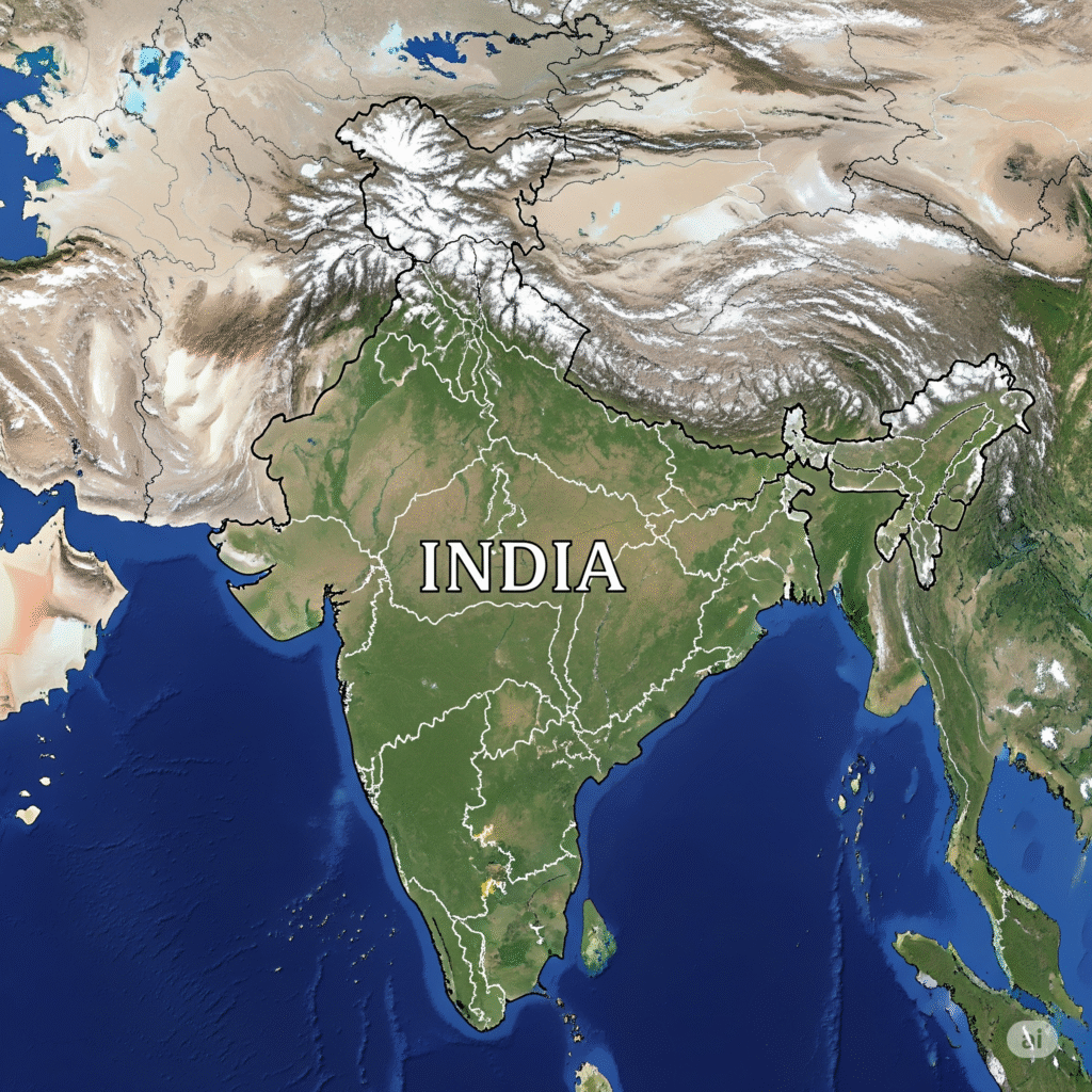
India is located in South Asia , which has a triangular shape. It is surrounded by the Himalayan mountain range in the north and extends to the Indian Ocean in the south. Boundaries of India: Geographically, it is spread in the Northern Hemisphere between 8°4′ North latitude to 37°6′ North latitude and 68°7′ East longitude to 97°25′ East longitude. The total area of India is approximately 32,87,263 square kilometers , making it the seventh largest country in the world.
- In reply: China , Nepal , and Bhutan
- Formerly: Bangladesh and Myanmar
- In the West: Pakistan and Afghanistan
- In the south: Indian Ocean , Lakshadweep and Sri Lanka
India’s land border is about 15,200 kilometers long , while its maritime border extends up to 7,516.6 kilometers. To understand the geographical expanse of India, it can be divided into four major borders:
(a) Borders in the North:
In the north, India is surrounded by the Himalayan mountain range , which acts as a natural protector. The following countries are located to the north of India:
- China: Ladakh shares borders with Himachal Pradesh , Uttarakhand , Sikkim and Arunachal Pradesh .
- Nepal: It shares borders with Uttarakhand , Uttar Pradesh , Bihar , West Bengal and Sikkim.
- Bhutan: It shares its border with Sikkim , West Bengal , Arunachal Pradesh and Assam.
(b) Borders in the East:
Mountainous regions and dense forests are spread in the east of India. The bordering countries here are:
- Bangladesh: It shares borders with West Bengal , Assam , Meghalaya , Tripura and Mizoram.
- Myanmar: It shares borders with Arunachal Pradesh , Nagaland , Manipur and Mizoram.
(c) Borders in the West:
To the west of India lies the Thar Desert and the vast plain of the Indus River. The major border countries here are:
- Pakistan: Shares borders with Jammu and Kashmir , Punjab , Rajasthan and Gujarat.
- Afghanistan: A small area , called the Wakhan Corridor , borders Afghanistan.
(d) Borders in the South:
South India is bordered by maritime boundaries , where the major water bodies are:
- Indian Ocean: Surrounds the coastal area of South India.
- Arabian Sea: Located on the west coast of India.
- Bay of Bengal: Spread along the eastern coast of India.
The nearest neighbouring countries of India to the south are Sri Lanka And Maldives These include Sri Lanka , with whom India has links through maritime borders. The Pamban Bridge and Adam ‘s Bridge mark the historic land link with Sri Lanka.
(ii) . Natural features
The natural features of India make it a unique geographical country. Its diverse climate , biodiversity , rivers , mountains , forests , and climatic zones have special significance. The natural features of India can be classified in the following manner and divided into four major climatic zones. Are:
(a) Climate and Weather:
- Tropical monsoon climate ( South India)
- Temperate Climate ( Himalayan Region)
- Desert climate ( Thar Desert of Rajasthan)
- Oceanic climate ( in western and eastern coastal areas)
India’s climate is tropical monsoonal , divided into four major seasons:
- Summer Season (March to June): High temperature and dry environment.
- Monsoon Season (June to September): Heavy rainfall due to south-west monsoon.
- Autumn (October to November): The weather starts getting cooler.
- Winter Season (December to February): Cold and dry environment.
(b) River systems:
The major rivers in India are divided into two parts:
- Himalayan Rivers: Ganga , Yamuna , Brahmaputra (rivers flowing in alluvial plains).
- Peninsular Rivers: Godavari , Krishna , Kaveri , Narmada , Tapti (rivers flowing through rocky areas).
(c) Forests and Biodiversity:
India has a variety of forest areas:
- Tropical Rainforests: In the Western Ghats and Northeast India.
- Dry Deciduous Forests: In central India.
- Desert Forests: In the dry areas of Rajasthan.
It is rich in biodiversity , including tigers , Asian elephants , one-horned rhinoceros and diverse bird species.
(d) Mountains and Plateaus:
- Himalaya Mountains: Located in the north , where the world’s highest peaks are located.
- Vindhya and Satpura Ranges: Located in central India.
- Deccan Plateau: Spread across Southern India , with hard rock structure.
(e) Desert and Coastal Areas:
- Thar Desert: Located in Rajasthan , with dry climate and sand dunes.
- Coastal Area: Extensive coastline with the Arabian Sea in the west and the Bay of Bengal in the east.
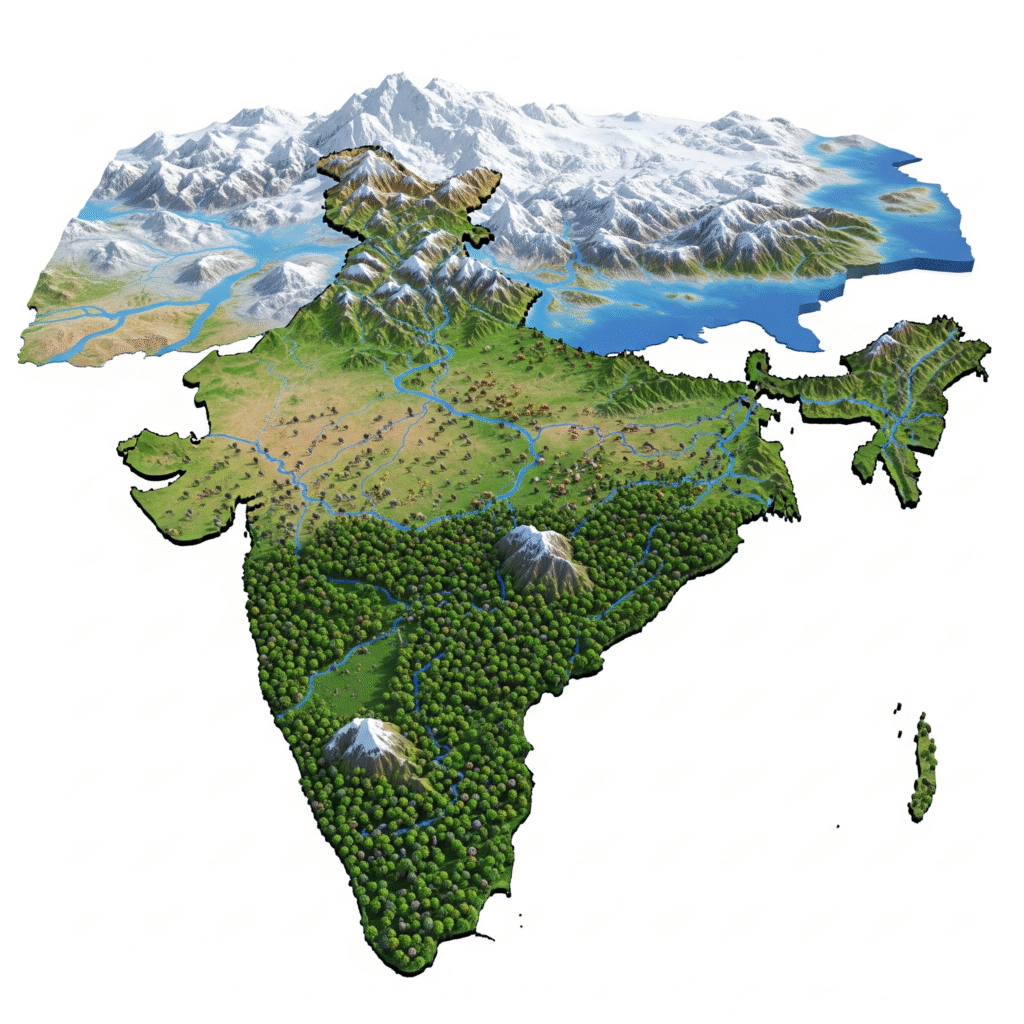
(iii). Major Geographical Regions of India

The geographical features of India can be divided into five major regions:
(a) Himalayan region
(a) Himalayan Mountain Region:
The Himalayan mountain range is spread across the northern part of India. It is the highest mountain range in the world , with peaks like Kanchenjunga. It not only acts as a natural boundary but is also the source of major rivers of India like Ganga , Yamuna , Brahmaputra.
The Himalayan mountain range is located in the north of India and is the highest mountain range in the world. The major peaks here are:
- Mount Everest ( 8,848 m) And Kanchenjunga ( 8,586 metres) .
- The Himalayas are important as the source of rivers like Ganga , Yamuna and Brahmaputra .
- The climate here is cold and snowy.
(b) Northern Plains
(b) Northern Plains:
This region is made up of alluvial soil of the Ganga , Yamuna and Brahmaputra rivers. The soil here is extremely fertile , making it an ideal area for agriculture. States like Punjab , Haryana , Uttar Pradesh fall in this region.
Ganga , Yamuna and Brahmaputra, this area is highly fertile. Features:
- Presence of alluvial soil , which is favourable for agriculture.
- Punjab , Haryana , Uttar Pradesh , Bihar etc. come under this region.
- The main crops here are: wheat , rice , sugarcane.
(c) Desert region
(c) Deccan Plateau:
The Thar Desert of Rajasthan is the main desert region of India. It has sand dunes , dry climate , and low rainfall. However , farming has been made possible here due to irrigation measures like Indira Gandhi Canal Project.
This plateau located in South India is made up of ancient rocks. Main features:
- Black soil , which is famous for cotton cultivation.
- Mountain ranges of Satpura , Vindhyachal , Western and Eastern Ghats.
- The major states here are: Maharashtra , Telangana , Karnataka.
(d) Deccan Plateau
(d) Coastal areas:
The Deccan Plateau is located in the central and southern parts of India. It is made up of hard rocks and black soil is found here , which is suitable for cotton cultivation. The Satpura , Vindhyachal , and Western Ghats hills are prominent here.
Vast coastal plains are found on the eastern and western coast of India. Major coastal areas:
- West Coast: Konkan and Malabar coasts (along the Arabian Sea).
- East Coast: Coromandel Coast (along the Bay of Bengal).
- Important for fisheries , ports and maritime trade.
(e) Coastal areas and islands
(e) Islands:
The eastern and western coastal plains of India are important for maritime trade and fisheries. The Arabian Sea lies on the western coast and the Bay of Bengal on the eastern coast. The Andaman-Nicobar and Lakshadweep Islands are famous for marine biodiversity and tourism.
India has two major archipelagos:
- Andaman and Nicobar Islands: Located in the Bay of Bengal , rich in biodiversity.
- Lakshadweep Islands: Located in the Arabian Sea , famous for its coral islands.
Note: Mount Everest is located in Nepal , while the highest peak in India is Kanchenjunga.
(a) Himalayan region
The Himalayan mountain range is spread across the northern part of India. It is the highest mountain range in the world , with peaks like Kanchenjunga. It not only acts as a natural boundary but is also the source of major rivers of India like Ganga , Yamuna , Brahmaputra.
The Himalayas can be divided into three major parts:
- Great Himalayas ( Greater Himalayas or Himadri):
- This is the tallest and oldest part.
- Major peaks like Kanchenjunga ( 8,586 m) and Nanda Devi ( 7,816 m) are located here.
- Most of this area remains covered with snow throughout the year.
- Middle Himalayas ( Lesser Himalayas or Himachal):
- It is situated south of the Great Himalayas.
- Mussoorie , Shimla , Nainital , Darjeeling are located here.
- The valleys here are Kangra Valley and Kashmir Valley.
- Shivalik Hills:
- This is the southernmost and lowest Himalayan region.
- The hills here are made of relatively new and weak rocks.
- The “Doon Valleys” such as Dehradun and Patlidoon are prominent in this region.
(b) Northern Plains
this area The northern plains are the most fertile and densely populated region of India , which It is made up of alluvial soil of the Ganga , Yamuna and Brahmaputra rivers . The soil here is extremely fertile , making it an ideal area for agriculture. States like Punjab , Haryana , Uttar Pradesh come in this region. This region is very important in terms of agriculture , trade and culture. It can be divided into three major parts:
- Western Part (Plains of Punjab and Haryana):
- is composed of alluvial soil from the Indus River and its tributaries (such as Sutlej , Beas , Ravi).
- Wheat and rice cultivation is prominent here.
- Haryana and Punjab have been the centres of Green Revolution.
- Central part (Ganga plains):
- is formed by the River Ganga and its tributaries (like Yamuna , Ghaghra , Gandak).
- Uttar Pradesh and Bihar are the major states in this region.
- paddy , wheat , sugarcane and pulses is prominent here.
- Eastern Part (Brahmaputra Plains):
- The area is composed of alluvial deposits of the Brahmaputra River and its tributaries.
- Assam , West Bengal and Tripura are located here.
- Tea plantation , paddy and silk production are the major agricultural products here.
The region is vulnerable to natural disasters such as floods and erosion , but its fertile land gives it a reputation as the “granary” of India.
(c) Desert region
The Thar Desert of Rajasthan is the main desert region of India. It has sand dunes , dry climate , and less rainfall. However , farming has been made possible here by irrigation measures like Indira Gandhi Canal Project. The desert region is located in the western part of India , which is called the Thar Desert This region is mainly spread in the western part of Rajasthan and some parts also extend in Punjab , Haryana and Gujarat. The Thar Desert is spread over about 2,00,000 square kilometers. Is.
Key Features:
- geographical coverage:
- The Thar Desert lies to the west of the Aravalli Mountain Range.
- It extends to the Sindh region of Pakistan.
- climate:
- Extremely hot and dry climate is found here.
- In summers the temperature can reach up to 50°C , while in winters the temperature drops to 0°C .
- Annual rainfall is very low ( 100–200 mm).
- Soil and Vegetation:
- Sand dunes and saline soil are found here.
- Plants that thrive in dry climate such as cactus , kikar , date palm and thor are common here.
- Water Source:
- There is a huge shortage of water here.
- Indira Gandhi Canal Project Irrigation has become possible through this , which has led to growth in agriculture.
- Economic Activities:
- Animal husbandry (camel , sheep , goat) is the main occupation.
- millet , sorghum , peanuts are grown.
- Tourism in Thar is also famous , like Jaisalmer , Bikaner ,
(d) Deccan Plateau
The Deccan Plateau covers the central and southern parts of India It is situated in. It is a huge triangular plateau , which is spread to the south of the Satpura and Vindhyachal mountain ranges. It is formed by ancient hard igneous rocks , which makes it geologically very strong. It is made up of hard rocks and black soil is found here , which is suitable for cotton cultivation. The hills of Satpura , Vindhyachal , and Western Ghats are prominent here.
- Expansion: This plateau extends across large parts of Maharashtra , Madhya Pradesh , Chhattisgarh , Telangana , Andhra Pradesh , Karnataka and Tamil Nadu.
- Land Structure: Black soil (Regur soil) is found here , which is famous for cotton cultivation.
- Major rivers: Rivers like Godavari , Krishna , Kaveri , and Mahanadi originate here.
- Natural wealth: Minerals like iron ore , coal , bauxite , and limestone are available in abundance here.
- climate: It has a tropical climate , with hot summers and relatively cool winters.
The region is famous for agriculture , mineral wealth , and cultural diversity.
(e) Coastal areas and islands
India’s coastal areas and islands are extremely important geographically: the eastern and western coastal plains are important for maritime trade and fisheries. The Arabian Sea lies on the western coast and the Bay of Bengal on the eastern coast. The Andaman-Nicobar and Lakshadweep islands are famous for marine biodiversity and tourism.
- Coastal Area:
- Western Coastal Plains: It is spread along the Arabian Sea and extends to Gujarat , Maharashtra , Goa , Karnataka , The coasts here are steep and major ports like Mumbai and Kochi are located.
- Eastern Coastal Plains: It is spread along the Bay of Bengal and extends to Tamil Nadu , Andhra Pradesh , Odisha and West Bengal. This area is wide and flat , where the delta region of rivers like Godavari , Krishna , Mahanadi is located.
- Islands:
- Andaman and Nicobar Islands: Located in the Bay of Bengal, these islands are famous for their biodiversity and natural beauty. Port Blair is the main city here.
- Lakshadweep Islands: Located in the Arabian Sea, these are coral islands , which are important for marine ecology and fisheries.
Chapter 2: Historical Development of India
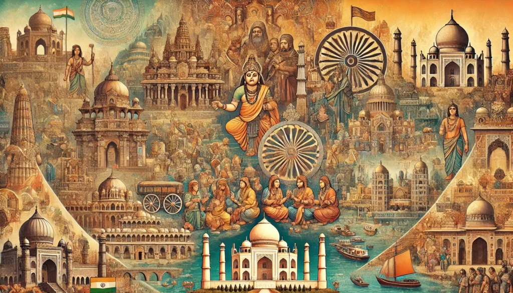
The historical development of India has been a rich and diverse process , with contributions from many civilizations , cultures , and dynasties. This development can be divided into different eras and periods , which define the social , economic , religious , and cultural character of India.
1. Ancient India ( 2500 BC – 600 BC)
(a) Indus Valley Civilisation ( 2500 BC – 1500 BC):
- One of the oldest urban civilisations in the world.
- Major cities: Harappa , Mohenjodaro ,
- Features: Planned town construction , drainage system , granaries , and trade network.
(b) Vedic Period ( 1500 BC – 600 BC):
- Composition of the Rigveda , which is the most ancient text.
- The society was divided into four varnas: Brahmin , Kshatriya , Vaishya , and Shudra.
- Arrival of the Aryans and their expansion in the Ganga Valley.
2. Mahajanapadas and Maurya Period ( 600 BC – 200 BC)
(a) Mahajanapada Period:
- Rise of 16 Mahajanapadas , like Magadha , Koshala , Avanti ,
- Development of urbanization and trade.
- Emergence of Buddhism and Jainism.
(b) Maurya Empire ( 322 BC – 185 BC):
- Founded by Chandragupta Maurya.
- Emperor Ashoka the Great , who adopted Buddhism after the Kalinga War.
- Administrative system , pillar inscriptions and rock inscriptions are famous.
3. Gupta Period and Golden Age ( 300 AD – 600 AD)
- The reign of the Gupta dynasty is called the “Golden Age” of India.
- Advances in science , mathematics , astronomy , literature , and the arts.
- Contribution of great scholars like Aryabhatta and Varahamihira.
4. Medieval India ( 1206 – 1707)
(a) Delhi Sultanate ( 1206 – 1526):
- Rule of the Slave Dynasty , Khilji , Tughlaq , Sayyid and Lodi dynasties.
- Development of architecture , like the Qutub Minar and Alai Darwaza.
(b) Mughal Empire ( 1526 – 1707):
- Founded by Babur , reached its peak during the rule of Akbar.
- Development of architecture like Taj Mahal , Red Fort , Fatehpur Sikri.
- Emphasis on religious tolerance and cultural unity.
5. Modern India ( 1707 – 1947)
(a) British Rule and Colonialism:
- British dominance after the Battles of Plassey ( 1757) and Buxar ( 1764) .
- 1857 : India’s first war of independence.
- Rise of social reform movements: Raja Rammohan Roy , Swami Vivekananda ,
(b) Freedom Struggle:
- Establishment of Indian National Congress ( 1885) .
- , Salt Satyagraha , and Quit India Movement under the leadership of Mahatma Gandhi .
- India gained independence on 15 August 1947 .
6. Independent India ( 1947 – present)
- Indian Constitution came into force ( 26 January 1950) .
- Democratic system , economic reform , and technological progress.
- science , technology , space research , and global diplomacy.